Loch Freuchie
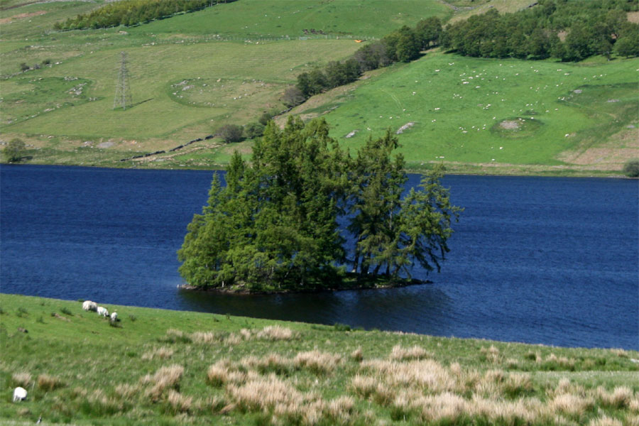
Mid-way along Loch Freuchie, and close to the the west bank, is a crannog.
It measures around 33.0m south-west to north-east by around 17.5m north-west to south-east, and rises out of the water by a maximum of 1.8m in the south-western half.


Where is Loch Freuchie?
Loch Freuchie is in the parish of Dull and the county of Perthshire.
Grid reference: NN 8619 3752
Lat / long: 56.515956, -3.851129
OS Map for Loch Freuchie

Directions to Loch Freuchie
Enter a starting point
Get directions

Weather at Loch Freuchie
6°C
max 7°C / min 6°C
max 7°C / min 6°C
5km/h NE
1006mb
58%
91%
04:40 19:45
1006mb
58%
91%
04:40 19:45
Overcast clouds
Weather observed at Perth and Kinross at 10:05

References (websites)
Ancient sites near Loch Freuchie
Castles near Loch Freuchie
Pictish stones near Loch Freuchie

Pictish sites near Loch Freuchie

Accommodation near Loch Freuchie
Moness House Hotel & Country Club
11.2km away
The Kenmore Hotel
11.9km away
Aberfeldy Weem Hotel
12.4km away
Coshieville House
14.4km away
Crieff Hydro self-catering cottages and chalets
15.0km away
Knock Castle Hotel & Spa
15.1km away
Crieff Hydro Hotel and Leisure Resort
15.2km away
Murraypark Hotel
15.3km away
Comrie Croft SYHA Hostel
15.7km away
Galvelbeg House
15.7km away
Accommodation search
Cafés, restaurants & bars near Loch Freuchie
The Watermill
11.5km away
Habitat Café
11.6km away
House of Menzies
12.1km away
Aberfeldy Weem Hotel
12.4km away
Famous Grouse Experience
13.9km away
Knock Castle Hotel & Spa
15.1km away
Crieff Hydro Hotel and Leisure Resort
15.2km away
Atholl Arms Hotel, Dunkeld
17.2km away
Torlum Café, Auchingarrich
19.4km away
Drummond Hotel
21.3km away


