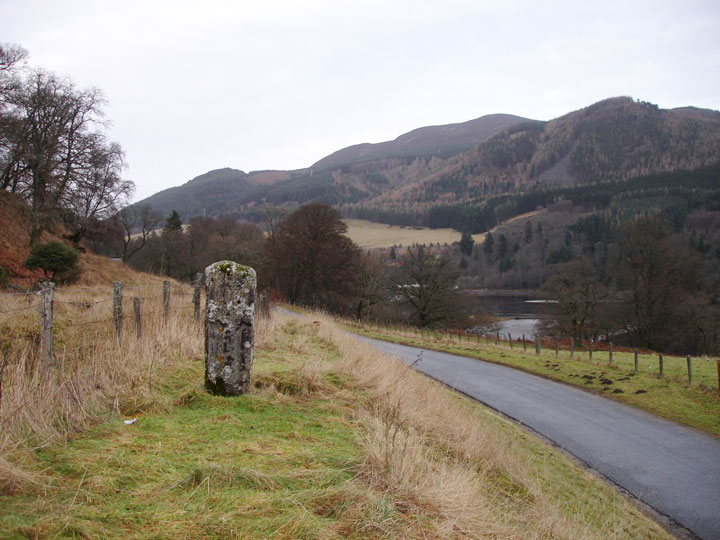
Priest's Stone
On one side is a badly-weathered cross.
On the other side is a second weathered cross, with the faint traces of a warrior figure at the base of the shaft.
It originally stood at NN 9153 5925 but was moved when the River Tummel was flooded to form the hydro-electric reservoir of Loch Faskally.
It measures 1.22 metres in height and is thought to date to the 7th century.


Alternative names for Priest's Stone
Chapel Stone
Where is Priest's Stone?
Priest's Stone is in the parish of Moulin and the county of Perthshire.
Grid reference: NN 9153 5925
Lat / long: 56.712343, -3.773519
OS Map for Priest's Stone

Directions to Priest's Stone
Enter a starting point
Get directions

Weather at Priest's Stone
3°C
max 3°C / min 2°C
max 3°C / min 2°C
10km/h NNW
1021mb
60%
20%
04:43 19:42
1021mb
60%
20%
04:43 19:42
Few clouds
Weather observed at Pitlochry at 06:48

References (websites)
Pictish stones near Priest's Stone
Pictish sites near Priest's Stone
Pictish placenames near Priest's Stone
Ancient sites near Priest's Stone
Castles near Priest's Stone

Accommodation near Priest's Stone
Green Park Hotel
1.8km away
Tigh na Cloich Hotel
1.9km away
Craigatin House & Courtyard
2.1km away
Pine Trees Hotel Pitlochry
2.2km away
Strathgarry Restaurant & Rooms
2.4km away
Pitlochry Backpackers
2.5km away
The Old Mill Inn
2.6km away
Fisher's Hotel
2.6km away
Craigmhor Lodge
2.7km away
Scotland's Hotel & Spa
2.7km away
Accommodation search
Cafés, restaurants & bars near Priest's Stone
The Auld Smiddy Inn
2.3km away
Strathgarry Restaurant & Rooms
2.4km away
McKays
2.4km away
The Old Mill Inn
2.6km away
Kingfisher Bar
2.6km away
Scotland's Hotel & Spa
2.7km away
Victoria's Restaurant
2.8km away
Moulin Hotel
2.9km away
Atholl Palace Hotel
3.5km away
Atholl Arms Hotel, Blair Atholl
7.5km away


