Wrae Tower
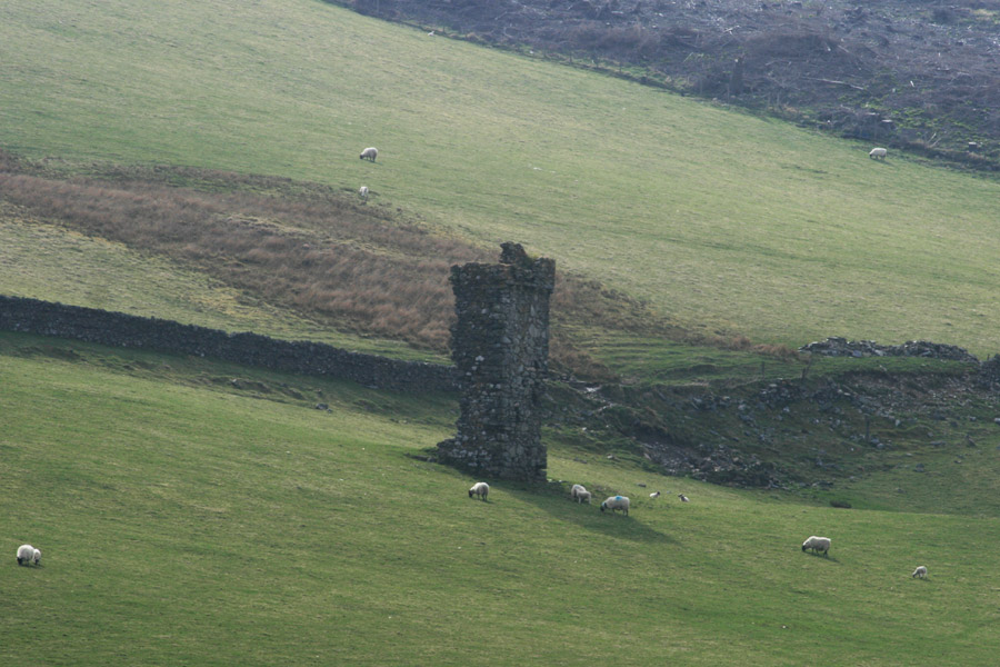
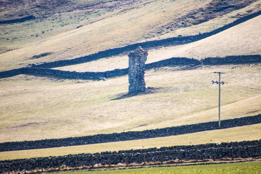
Wrae Tower was a 16th century tower house, of which only a tall section containing a stair remains standing.
It is situated on the north shoulder of Wrae Hill, looking over the Tweed valley below, and on the opposite side of the river to Drumelzier Castle.
Exactly when the first castle was built at Wrae is unclear, however the remains standing today suggest that this portion at least was built in the 16th century. It may of course have replaced or been attached to an earlier building. It is said that the family of Geddes of Rachan and Kittlehall owned the lands of Wrae initially.
What is known is that a castle was here at least as early as 1524. In that year James Tweedie of Wrae was involved in the murder of John, 2nd Lord Fleming, along with a group of Tweedies, including John Tweedie of Drumelzier, Thomas Tweedie of Oliver Castle and James Tweedie of Kilbucho.
This was part of a long running feud between the Flemings and Tweedies, and led to the Tweedie property of Tinnis Castle being destroyed with gunpowder by the 2nd Lord Fleming’s son, Malcolm, 3rd Lord Fleming.
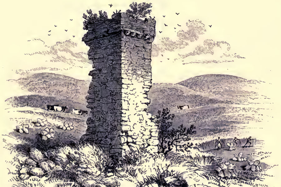
All that remains standing is the north-east half of a rectangular wing, which rises to a height of around 8.8m at the north corner. The wing measures around 3.7m in width approximately north-west to south-east, while the ruins of the north-west and south-east walls vary in length from around 1.7m to around 3.0m.
On the north-west wall there was an entrance, represented by a single door jamb containing a bar-hole. The entrance opened directly onto a staircase which rose to first floor level only. Above the stair was a room, and another in the attic. Evidently there was a further stair in the now lost part of the castle giving access to the second floor from the first.
Around 7.6m from the ground on the north-east wall only are rough corbels supporting the remains of a parapet walk.
In 1632 or 1633, due to declining fortunes, the Tweedies were forced to sell their main seat of Drumelzier Castle to John Hay, 8th Lord Hay of Yester, and it is thought that they moved to Wrae Tower at this time.
The last mention of the Tweedies of Wrae in the Records of the Parliament of Scotland seems to be in 1649, when William Tweedie of Wrae is included in a list of landowners regarding an “Act for putting the kingdom in a posture of defence”. William was part of the Scottish army under General Leslie, and is mentioned in this capacity in 1656.
In 1679 the lands of Wrae were included in a charter to Sir William Murray of Stanhope, and some time after this they became the property of the Hunters of Polmood. This may have occurred when Robert Hunter of Polmood married Veronica Murray, daughter of Sir David Murray of Stanhope, in 1721.
It seems likely that by this time Wrae Tower was in ruins, as it isn’t marked on Roy’s Military Survey of 1752 – 1755 so obviously was no longer considered a place of significance.On Mostyn Armstrong’s “Map of the County of Peebles or Tweedale”, published in 1775, it is marked as “ruins”.
Walter Hunter’s daughter, Elizabeth, married James Forbes, 17th Lord Forbes, in 1792, and Wrae passed into the Forbes family in 1796 upon the death of Walter. In 1847 Thomas Tweedie of Quarter, who had been buying up lots of estates in the area, bought the lands of Wrae from Lord Forbes.
Over the years Wrae Tower was evidently used as a source of stone for building field dykes, and by the late 19th century it was more or less in its current ruinous state. Interestingly the Ordnance Survey Six-inch map of 1859 shows the ruins with an L-plan outline, but whether or not this accurately represented what was visible on the ground at that time is unclear.

Today the ruined gable end of Wrae Tower stands in an arable field to the south-west of Wrae Farm.


Alternative names for Wrae Tower
Wrae Castle