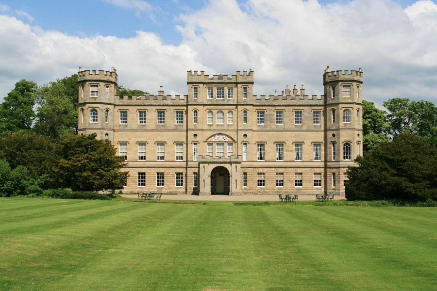
Wedderburn Castle
Wedderburn Castle is an 18th century Adam mansion which incorporates an old tower house.
In 1490 George Hume of Wedderburn was granted the lands of Morristoun in Berwickshire which Andrew Anstruther of Anstruther had resigned.
In September 1545 the Castell of Wetherburne was burned by an English army led by Edward Seymour, Earl of Hertford.


Alternative names for Wedderburn Castle
Castell of Wetherburne; Wetherborne; Wetherburne