Tenandry House
Tenandry House once stood at the eastern end of present day Greenlaw, but no trace of it now remains.
The history of Tenandry is not well documented, but it is recorded as having been granted by George de Dunbar, the 11th Earl of March and Dunbar, to George Inglis, his armour bearer, in 1422.
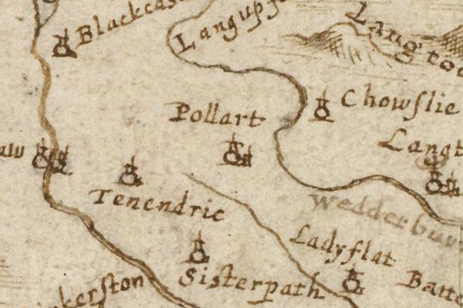
It appears on Robert Gordon’s mid-17th century map “A description of the province of the Merche”, as Tenendrie.
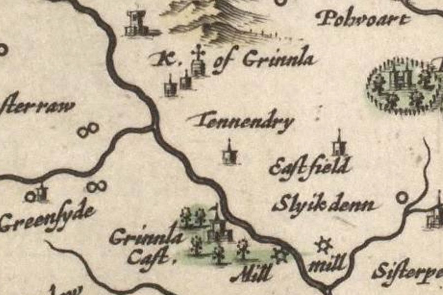
It is also shown in Joan Blaeu’s Atlas of Scotland, published in 1654 but based in part on Timothy Pont’s maps of the late 16th to early 17th century, as Tennendry.
It is thought to have been a castle of some sort, although I have not as yet found a good description of it, and stood on a natural knoll on the opposite side of the Blackadder to Greenlaw Castle.
There were apparently still some remains to be seen around 1815, but the last of these were removed along with the foundations “a few years before 1863”, and nothing can now be seen. The site is now within a caravan park called The Moat.


Alternative names for Tenandry House
Tenendrie; Tennendry
Where is Tenandry House?
Tenandry House is in the parish of Greenlaw and the county of Berwickshire.
Grid reference:NT 7187 4629
Lat / long:55.709226,-2.4492322