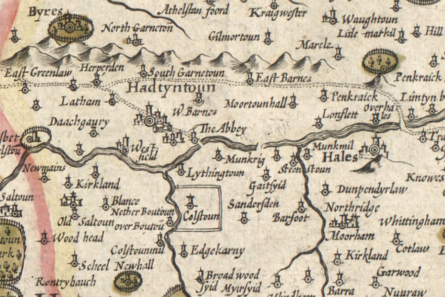
Stevenson House
A new description of the shyres Lothian and Linlitquo
Hendrik Hondius, Amsterdam, 1630map image courtesy of NLS
Hendrik Hondius, Amsterdam, 1630map image courtesy of NLS


Alternative names for Stevenson House
Steenstoun; Stevenston; Stevenstoun; Stevinstoun