Skirling Castle
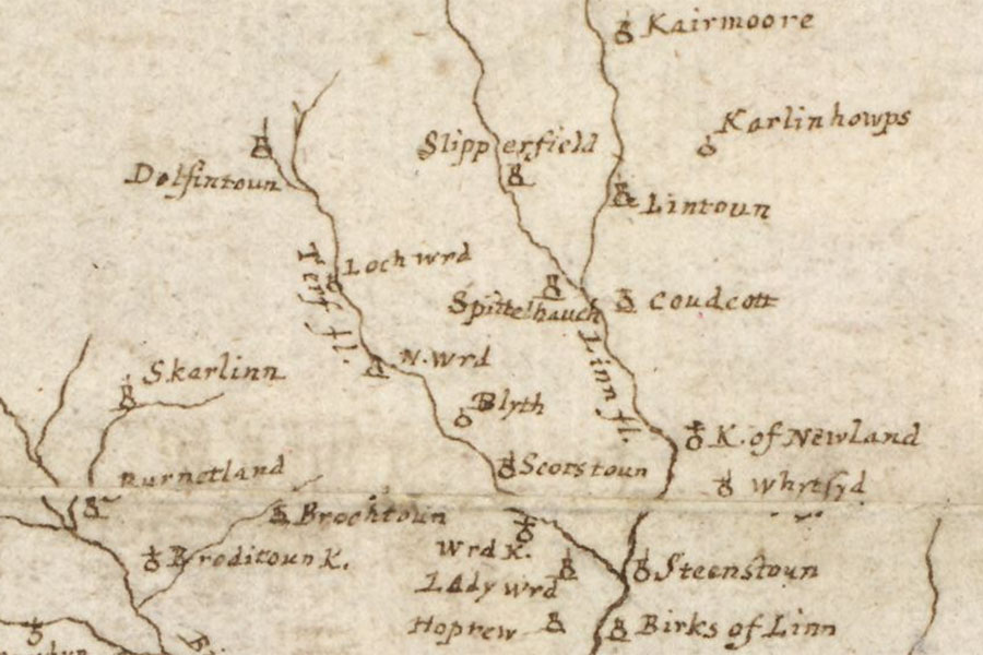
A map of the Clyde and Tweed basins
Robert Gordon, c. 1636 – 1652map image courtesy of NLS
Robert Gordon, c. 1636 – 1652map image courtesy of NLS
Skirling Castle was a 15th century tower although only earthworks now remain.
In the late 14th century Sir William de Cockburn of Scraling married Christian de St. Clair, daughter of Sir Walter de St. Clair of Cessford, and Cessford Castle passed into the Cockburn family.
Their son was styled Alexander Cockburn of Skraling and Cessford and his sons, Adam and William, used the same geographical indicators.


Alternative names for Skirling Castle
Scraling; Skarlinn; Skraling