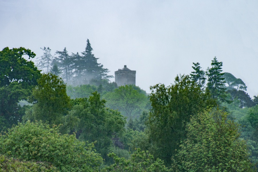
Repentance Tower
Repentance Tower is a 16th century tower house which stands on a hill overlooking the River Annan and Annandale.
When the Bruce family were granted the lordship of Annandale in the 12th century they divided the area into baronies, one of which was the barony of Hoddom (or Hodelm) the seat of which is thought to have been at Old Hoddom Castle. Uduard or Odard de Hodelm and Robert de Hodelm witnessed charters in the area in the late 12th and early 13th centuries and Adam de Hodolm swore allegiance to Edward I of England in 1296.
The importance of Hoddom seems to have declined around this time and the Hoddom family seem to have moved away. It may have been after this period that the seat of the lands moved west across the River Annan from Old Hoddom Castle to Hoddom Castle, although this is speculation on my part.
During the 14th century the ownership of Annandale passed backwards and forwards between Scotland and in 1312 the lordship was granted to Thomas Randolph, 1st Earl of Moray, by Robert the Bruce. Annandale passed to Randolph’s two sons in succession, Thomas and John, and then to his daughter, Agnes Randolph, who was married to Patrick, 9th Earl of March. Seemingly none of their children survived and Annandale passed to George Dunbar, 10th Earl of March, variously described as Patrick’s nephew or first cousin once removed.
The 10th Earl forfeited Annandale in 1409 and Archibald Douglas, 4th Earl of Douglas, took possession. Douglas subsequently granted the lands of Hoddom to Simon de Carruthers and in 1452 James combined Hoddom with various other Carruthers lands and erected them into the barony of Carruthers. Hoddom later returned to the Douglas family with Archibald, 5th Earl of Angus, who in 1495 granted the lands to Andrew Herries, the eldest son of Herbert, 1st Lord Herries of Terregles, upon his marriage to Janet, the youngest daughter of the Earl of Angus.
In 1543 William, 3rd Lord Herries of Terregles, died and left Hoddom, divided into three parts, to his three daughters. Agnes, the eldest daughter, married Sir John Maxwell, the second son of Robert Maxwell, 5th Lord Maxwell, in 1547. Two years later she granted her share of the lands of Hoddom, comprising of the lands of Knockhill, Whitehill and Duke’s Close, to Richard Irving, known as Old Duke Richie, “for the good and faithful services done” to her and her husband.
Lady Agnes’ sisters, Katherine or Catherine and Janet Herries, granted their two thirds of the Herries estates, including the two thirds of the lands of Hoddom, to John Hamilton, son of James Hamilton, 2nd Earl of Arran, in 1550 and 1552 respectively. In 1561 Maxwell bought the Herries lands from Hamilton and united them with those of his wife. In 1565 Maxwell began building the new Hoddom Castle and Repentance Tower on a neighbouring hill.


Alternative names for Repentance Tower
Repentace; Tour of Repentace; Tower of Repentance; Trailtrow