Renton Peel
Renton Peel once stood a short distance to the north-east of Renton House, but nothing of it now remains.
In the 11th century the “mansio of” Renton was granted by King Edgar to the monks of Coldingham Priory which was under the authority of the Church of Durham. The area was forested at the time and the family who resided at Renton had, by the reign of William the Lion, become hereditary foresters responsible for the woods of Renton, Reston, Brockholewood, Akeside, Kirchedeneswood, Harewood, Swinewood and Houndwood. The family took the name Renton, although some apparently also used the surname of Forester.
When the earliest castle was built at Renton is unknown, as is what form it took. It’s possible that its earliest incarnation was built from wood and may date back to the 11th or 12th centuries. This building would likely have been replaced at a later date with a stone structure.
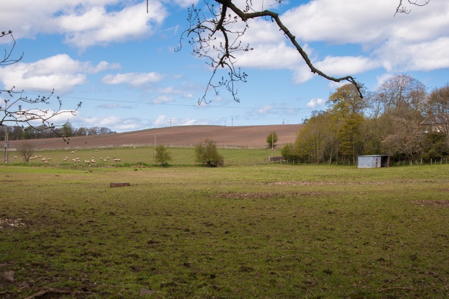
The site of the castle is on rising ground to the north of the Eye Water, approximately halfway between the Howpark Burn to the west and the Atton Burn to the east. It may not immediately seem like a particularly good defensive position, with higher ground to the north of it, however the valley below was, and still is, a major route between Scotland and England and the castle would have overlooked it.
A Richard of Renton is mentioned in documents dating to the first half of the 13th century as being married to Mariota of Chirnside, with whom he had a son, Patrick. The “villa of Renton” is mentioned in various 13th and 14th century documents, however during the 15th century the male line of the Rentons of Renton died out. In 1498 the female heir married into the family of Ellem and the barony of Renton passed into that family. Other branches of the Rentons had acquired property in the surrounding area, and the Rentons of Billie are mentioned in charters in the 15th and 16th centuries, and the Rentons of Lamberton from the 16th century.
Given its position close to the border with England it is unsurprising that the castle at Renton featured heavily in the wars of the 15th and 16th centuries. It was razed in 1515 and again on the 17th of May 1544 when the English army of the Earl of Hertford destroyed it on their way to Berwick.
The male line of the Ellems of Renton died out upon the death of David Ellem of Renton, and in 1558 his daughter Janet married Patrick Home of Killknow, son of Alexander Home of Manderston, at which point Renton passed to the Home family.
I have been unable to establish if Renton Peel was rebuilt after 1544, however Renton appears on 17th century maps suggesting it was still a place of some importance. It should be noted however that the village of Renton stood to the north-west of the castle and it may be this which is being referenced, although Blaeu’s tower symbol is used.
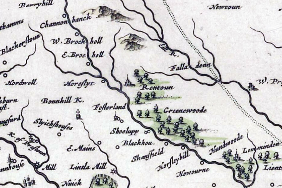
Joan Blaeu, Amsterdam, 1654map image courtesy of NLS
Renton House was built a few hundred metres to the west, possibly in the early 18th century. Whether or not it replaced an earlier house is unclear. A sundial carved with the date 1715 has led to the suggestion that Renton House was built in this year.
By this time Renton Peel was certainly in ruins and the last remains of the tower were removed in the 18th century during improvements, presumably related to the landscaping of the new house’s grounds.
When Sir John Home of Renton died in 1785 the title and lands of Renton were inherited by his cousin Sir Alexander Stirling of Glorat. Alexander’s mother, Elizabeth, the eldest daughter of Sir Alexander Home of Renton, had married Sir John Stirling, third son of Sir George Stirling of Glorat. Renton remained a Stirling property until the 20th century.
In 1956 a large stone, said to be from Renton Peel, occupied the site but that now seems to have gone. All that remains to identify the site of the castle is the slightest of indistinct mounds measuring approximately 18.0m in diameter.


Alternative names for Renton Peel
Ranton; Ranynton; Raynton; Rayntoun; Regnintun; Reignintun; Rentoun; Rentown; Tower of Renton