Prickinghaugh Tower
Prickinghaugh Tower was a likely 16th century tower house belonging to the Elliot family but nothing of it now remains.
The exact location is disputed. On 19th century Ordnance Survey maps the site of Breaken Tower is marked at NY 5438 9432 on the east bank of the Liddle Water, however on older maps the tower is shown on the opposite bank close to the confluence with the Todscleuch or Todshaw Sike.
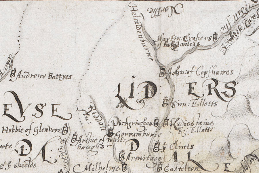
The tower is labelled as Pickeringhaw on a map of 1590 which appeared in “An atlas of England and Wales, made by Christopher Saxton”, a book owned by William Cecil, 1st Baron Burghley, and commonly referred to as The Burghley Atlas.
The tower is said to have been demolished in 1792 and stone from it used in the construction of a wall.


Alternative names for Prickinghaugh Tower
Breaken Toor; Breaken Tower; Packing Haug; Pickeringhaw; Pricken Haugh; Prickenhauch; Prickenhaugh; Pricking Haugh Tower; Prickinhauche; Prikinghaus