Newton Castle
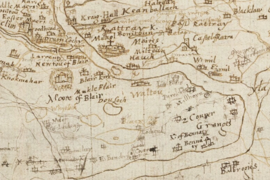
Strathardle; Glenshee and GlenerichtTimothy Pont, c. 1583 – 1596map image courtesy of NLS
Newton Castle is marked on Pont’s late-16th century map as Newton of Blair.
Legend has it that Newton Castle is connected to Ardblair Castle by a tunnel, however this seems unlikely given the distance of over a kilometre.


Alternative names for Newton Castle
Newton of Blair
Where is Newton Castle?
Newton Castle is in the parish of Blairgowrie and the county of Perthshire.
Grid reference:NO 17169 45273
Lat / long:56.592043,-3.350316