Kilspindie Castle
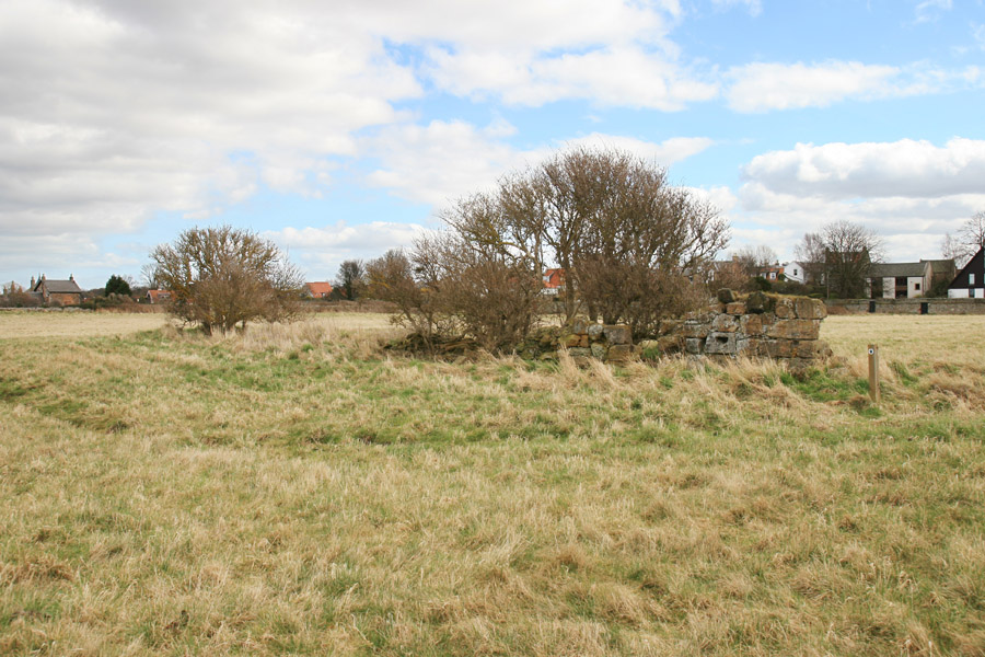
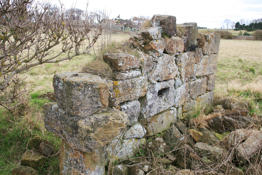
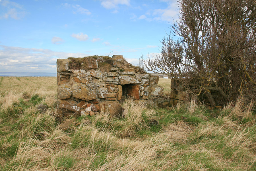
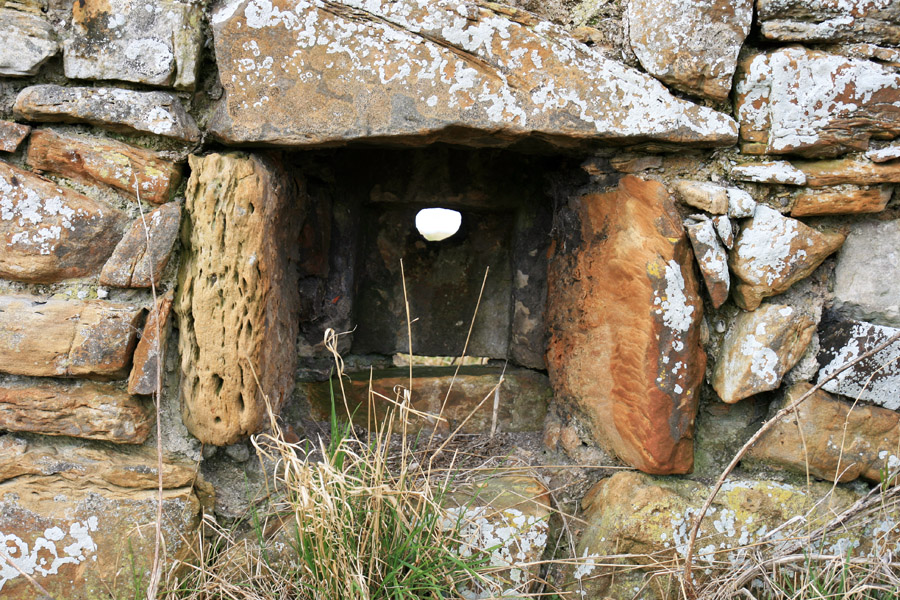
Kilspindie Castle dates back to the 16th century. All that now remains above ground is an 8.0 metre long section of the north wall, standing to a maximum height of around 1.60 metres at the western end of it.
Within this section of wall, which is about 0.8 metres thick, is a clearly-defined doorway and a gun loop beside it.
A heavy studded door from the castle was taken to nearby Luffness House, while various stones were taken for use as building materials for properties in Aberlady.


Where is Kilspindie Castle?
Kilspindie Castle is in the parish of Aberlady and the county of East Lothian.
Grid reference:NT 4617 8004
Lat / long:56.010238,-2.864846