Inchbervis Castle
The ruins of Inchbervis Castle probably date back to the 14th or 15th centuries, although the site may have been fortified at an earlier date.
Inchbervis Castle occupies a fine defensive position, situated on a mound within a roughly D-shaped enclosure located at the eastern end of a long promontory created by a bend in the River Tay. Little is known about the early history of the site and the name has changed considerably over the centuries but it seems to be the same place as that named Incheturfin which was owned by the church of the Holy Trinity of Dunkeld in the 12th century. The name is thought to mean the island or perhaps headland of Torfin, a Scandinavian personal name.
A charter from Dunkeld in 1130 refers to Incheturfin, and around 1153 Andrew, bishop of Caithness, granted to Abbot Geoffrey of Dunfermline the church of the Holy Trinity of Dunkeld and its lands of Fordouin, Dunmernach, Bendacthin, Cupermaccultin, Inchethurfin and Chethec. This grant was confirmed on the 27th of July 1164 when the church’s lands were written as Forduuin, Dulmernok, Bendochy, Couttie, Incheturfin and Keithick.
An undated document thought to have been written some time between around 1220 and 1250 recognises the boundary between the lands of the lord king of Herbertoli (now Airntully) and the lands of Inchesturphyn which belonged to the abbot and convent of Dunfermline, while Incheturphin is recorded in a document from 1234. The abbey of Dunfermline is mentioned as owning the lands of Fordie, Couttie, Bendochy, Little Keithick, Inchturfin and Dummernech in 1255 and 1256.
The castle was supposedly visited regularly by William Wallace which led to it having been referred to as Wallace’s Castle in the past, although I haven’t been able to find an original reference for this and it may just be a legend. However Wallace is known to have attacked the nearby Kinclaven Castle in 1296 so he was certainly active in the area.
The promontory is thought to have been fortified in the 13th century when the lands may have been held by Robert de Oghtergeven or Robert of Auchtergaven. He is on record in 1296 performing fealty to Edward I of England.
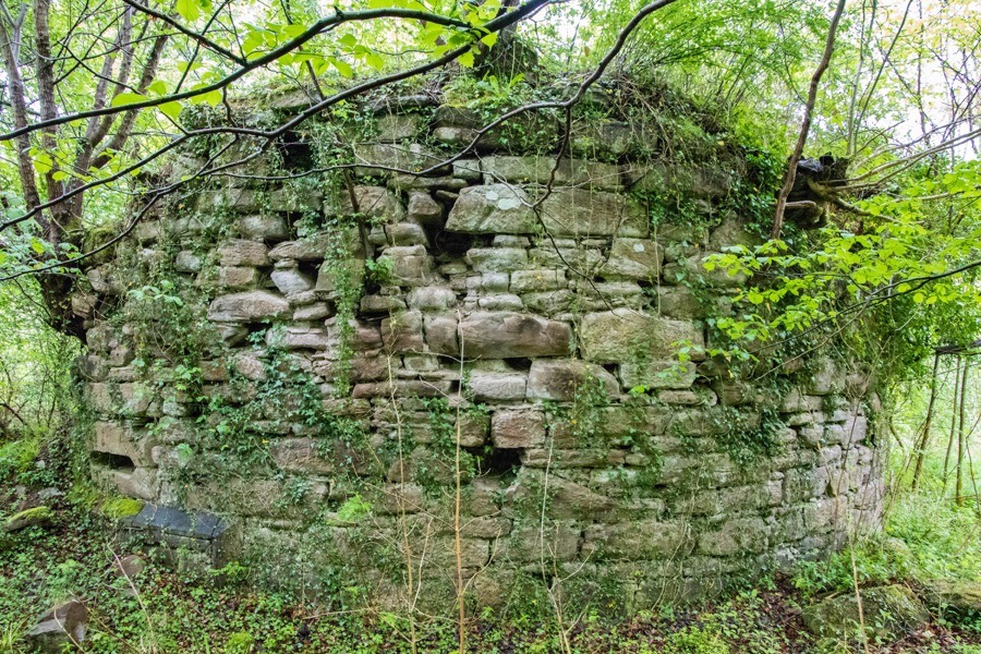
The site is protected on the north and north-east sides by natural slopes down to the Tay and on the south-west side by an artificial rampart and ditch, the former now around 1.0m high and the latter around 1.7m deep.
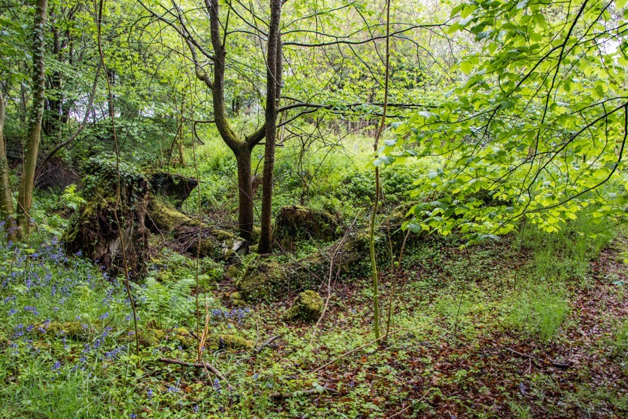
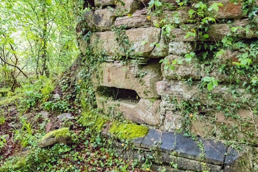
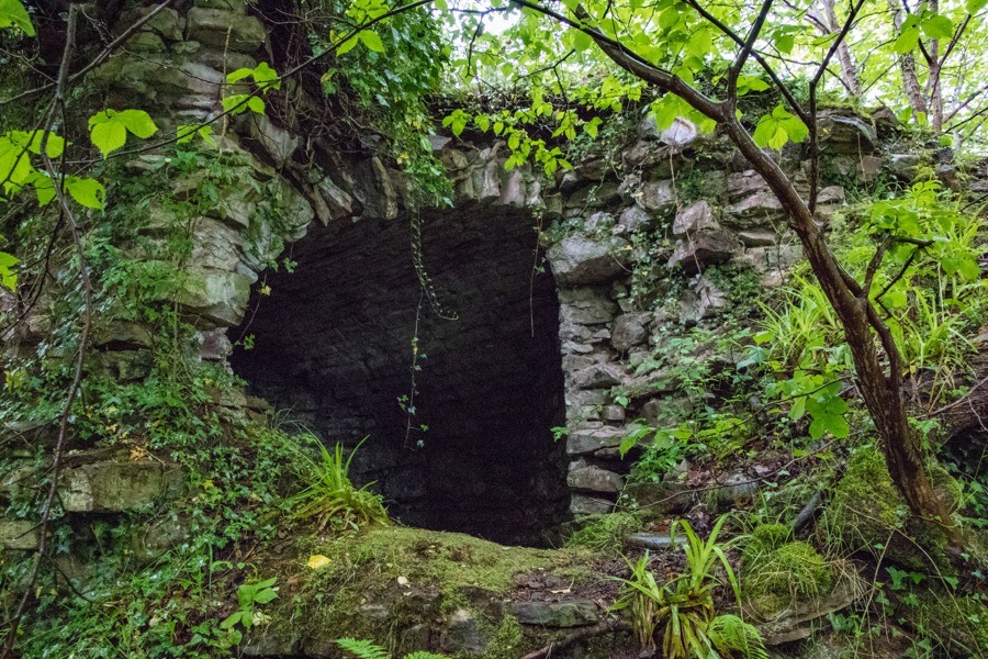
The south-east side would presumably also have been protected by a rampart and ditch but now on this side there is only the spread of the castle mound. What form the castle originally took is not known, however it seems likely that what is now left is just a part of a larger building. The ruins consist of a roughly D-shaped tower with the curved edge facing west towards the rampart and ditch. Just above ground level in the middle of the curved wall is a wide splayed gun loop.
Further around the curved wall a second similarly-positioned gun loop points along the outside edge of the low remains of a wall which extend approximately north-west from the tower.
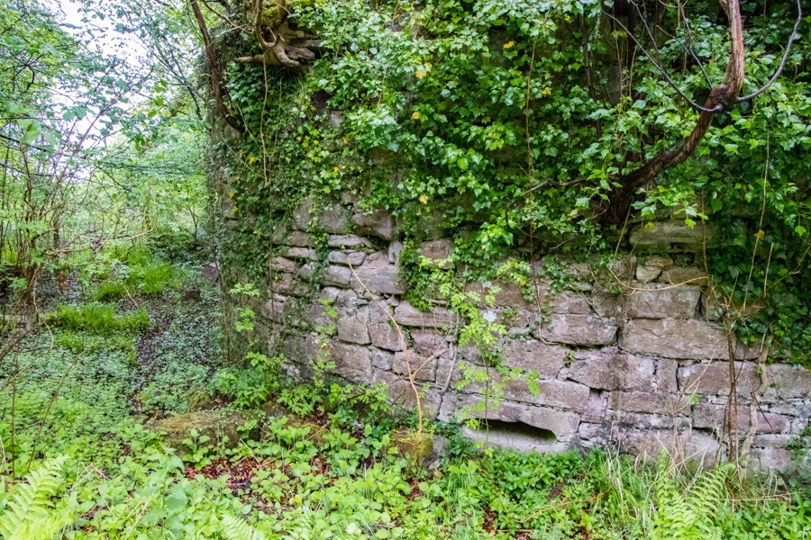
The remains contain a double height chamber under a vaulted ceiling which rises to around 5.0m tall. The lower half of the chamber is below the surrounding ground level. Corbels on the interior walls suggest the space was divided by an entresol floor. Behind the gun loop in the west wall is a deep, arched chamber stolen from the thickness of the wall.
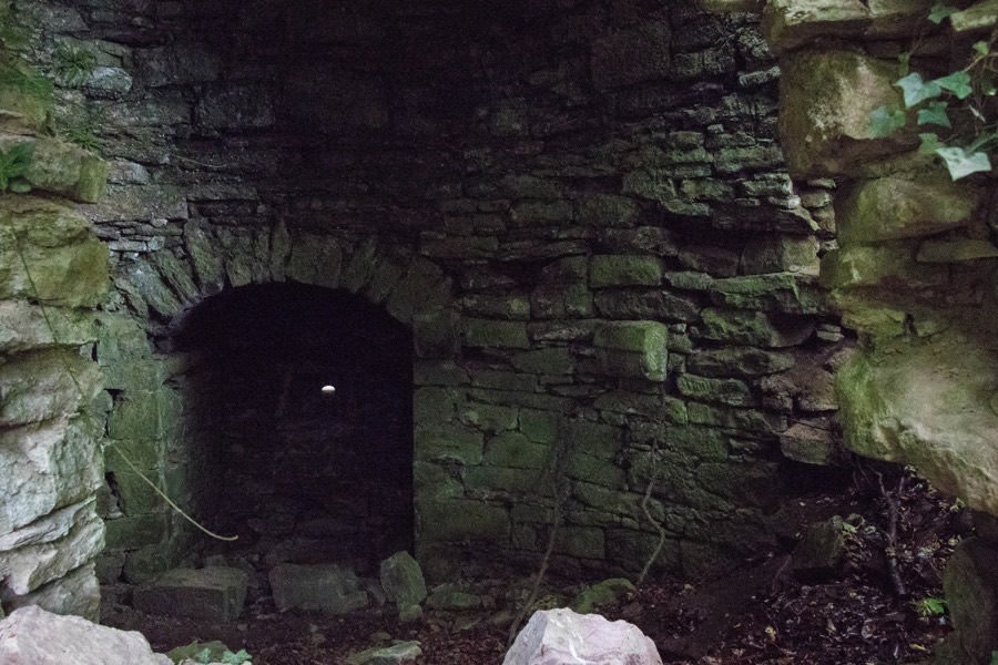
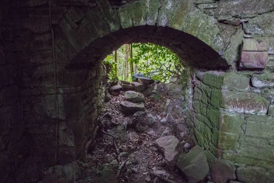
To the south is a similarly-styled chamber which now opens right through to the exterior, although it isn’t clear if the outer wall of the chamber has fallen or if this was originally some kind of passageway or entrance.
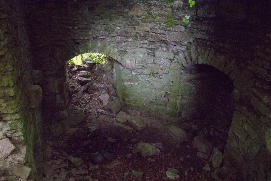
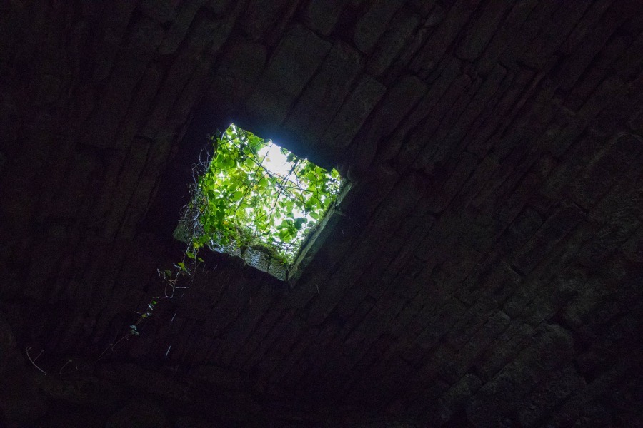
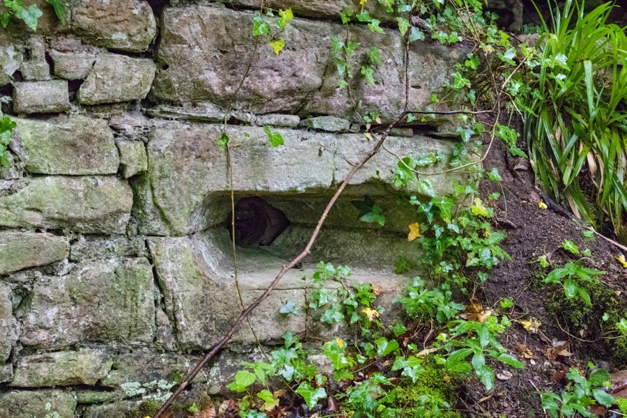
The walls are some 2.7m thick in places suggesting an early date of construction, possibly in the 14th century, although it is entirely possible it replaced an earlier structure given the 12th century references to the property. The lands are mentioned in a 14th century charter as Incheturfy. In the middle of the vaulted ceiling is a square opening which may originally have led up to a kitchen above the basement level.
A large section of the north corner has fallen, revealing the vaulted ceiling within.
Just to the east of this opening is a third gun loop, again close to ground level.
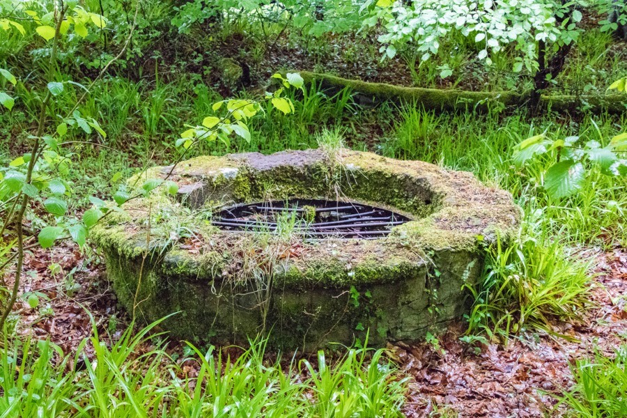
To the north-east of the castle is a stone-lined well.
Writing in 1883 Hunter refers to “a dungeon, now almost filled up” but it isn’t clear whether he is referring to the basement level of the castle or a chamber further below that. Either way there is a tradition that a tunnel under the river connected the castle with Stobhall on the opposite bank of the Tay, although considering an almost 2km distance this seems unlikely.
Interestingly Hunter also states that Stanley House “was built about 450 years ago”, placing it in the first half of the 15th century. It may be that Stanley House was constructed as a replacement for the old castle.
There doesn’t appear to be much mention of the castle until the 16th century when George Durie, the abbot of Dunfermline, granted the lands, named in the document as Inchetrewie, to John Ross of Craigie and his wife, Matilda Moncrieff, in 1539.
The castle is marked on two different Pont maps, published in the late 16th century. On a map of the area of Auchtergaven and Kinclaven it is named Inchtreuy and drawn as a pair of towers joined by a wall or lower block through which is an arched gateway. The left tower seems to be four or five storeys in height with crenellated battlements while the right tower is three or four storeys in height with a pitched roof.
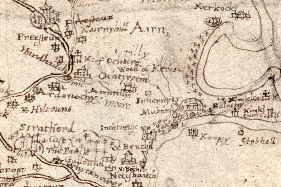
Timothy Pont, c.1583-96map image courtesy of NLS
On a map of Lower Strath Tay from Dunkeld to Benchil which partly covers the same area it is marked as Inchtyruy and drawn as a large four or five storey tower with crenellations.
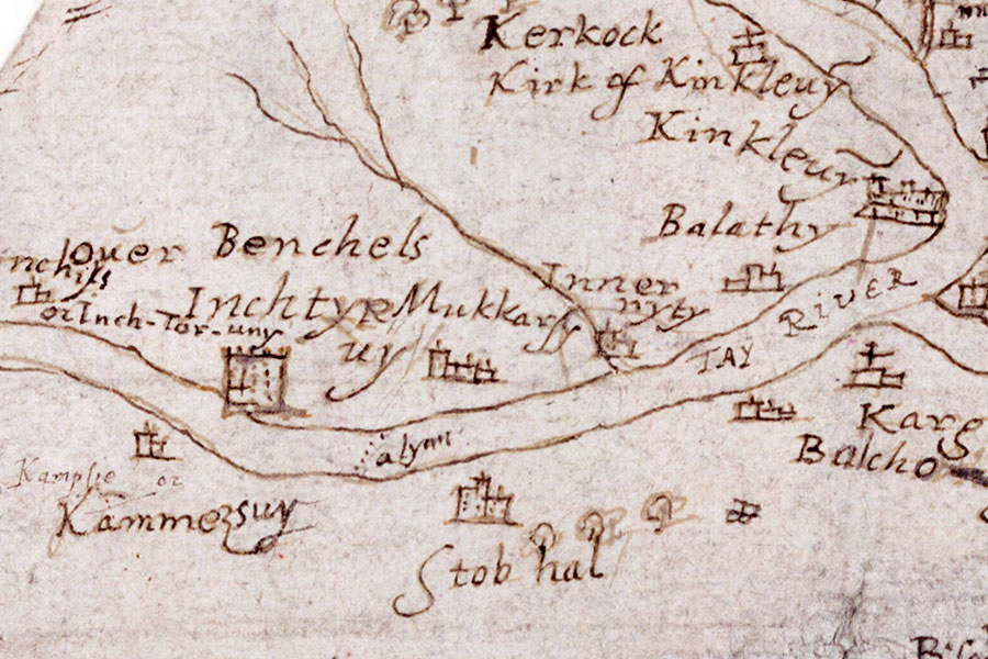
Timothy Pont, c.1583-96map image courtesy of NLS
The property seems to have remained in the hands of the Ross family into the 17th century as on the 9th of March 1605 Robert Ross received a charter of the lands of Inchstravie, while a charter dated the 5th of December 1606 confirms John Ross as owning the lands of Inchstrevie.
Thomas Nairne of Muckersie, a neighbouring property to Inchbervis, bought the lands of Mains of Auchtergaven from Christina Ross, the daughter and co-heiress of John Ross, in April 1605, and it may be that the Nairne family also took possession of the lands of Inchbervis around this time as by 1627 they were owned by Thomas’s son, Robert Nairne.
Robert was an advocate and had succeeded to the lands of Muckersie by July 1621 when he was granted a charter of the lands of Redgorton, Blackhall, Auchtergaven and others which were erected into the free barony of Strathord. In 1628 he was described as the “proprietor of the barony of Strathord and the lands of Inchstrevie” or Inchetrevie along with his wife Catharine or Katherine Prestoun.
The property is marked in Blaeu’s mid-17th century Atlas of Scotland as Inchetrevy, and on the 17th of September 1681 there was a ratification in favour of Robert Nairne, 1st Lord Nairne, of “the lands of Inschtrivie, with the tower and fortalice, called Blockhous Manor place of Inschtrivie”. It is marked on Adair’s map of 1685 as Inchtryve and on another of his maps, thought to have been published around 1720, as Inchtrive. This same spelling appears on Moll’s map, published in 1745 but surveyed before his death in 1732.
John Nairne, who would have been the 3rd Lord Nairne had the title not been forfeited due to his father’s involvement in the Jacobite rising of 1715, is said by some authors to have narrowly escaped capture at the castle following his involvement in the rising of 1745 by fleeing the dining room. However it seems that this story more likely refers to Stanley House.
Inchbervis Castle doesn’t appear to be marked on Roy’s mid-18th century map although Stanley House appears as Stanley.
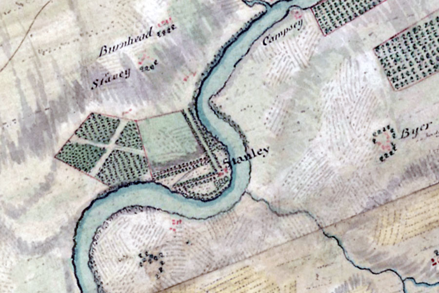
William Roy, 1747-1752map image courtesy of NLS
Exactly when Inchbervis fell into ruin is unclear. It could have been as early as the 15th century if it was indeed replaced by Stanley House, or the two may have co-existed as separate properties for several centuries. It must also be considered that if Stanley House was built at that time then, given that it wasn’t renamed Stanley until the late 17th or early 18th century, it may be that building that was being referred to in documents and maps.
What is clear is that Inchbervis is marked on Knox’s map of 1850 as the ruins of Inverstruvie Castle, on the 1st edition of the Ordnance Survey Six-inch map, surveyed in 1864 and published in 1867, as the remains of Inchbervis (or possibly Inchberris) Castle, and on the 1st edition of the Ordnance Survey 25 inch map, again surveyed in 1864 and published in 1867, as the remains of Inchbervis Castle.
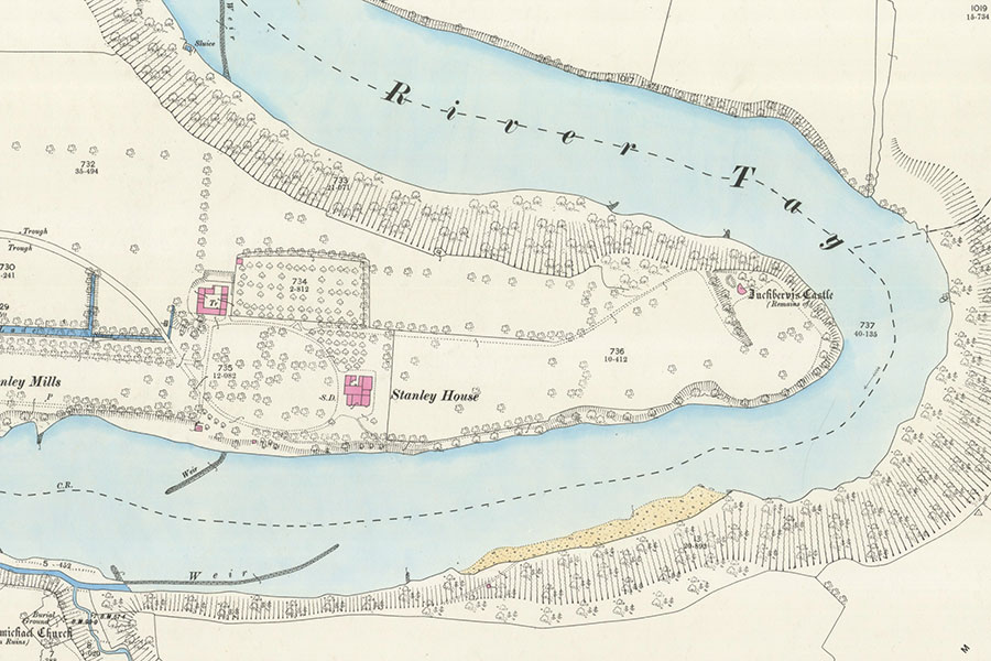
Ordnance Survey, 1867map image courtesy of NLS
Some authors state that a mansion was constructed next to Inchbervis, or that the castle was greatly altered in the 19th century, that it burnt down in 1887 and then rebuilt, however this actually refers to Stanley House rather than Inchbervis.
Today the ruins of Inchbervis Castle stand in woodland within the policies of Stanley House, partially hidden by overgrown vegetation.


Alternative names for Inchbervis Castle
Inchberris Castle; Inchbervie Castle; Inchesturphyn; Inchesturphyne; Inchethurfin; Inchetrevie; Inchetrevy; Inchetrewie; Incheturfin; Incheturfy; Incheturin; Incheturphin; Inchrivers Castle; Inchstravie; Inchstrevie; Inchtervy; Inchtreuy; Inchtrive; Inchtryve; Inchturfin; Inchturfy; Inchtyruy; Inschtrivie; Inverbervie; Inverstruvie Castle; Wallace's Castle