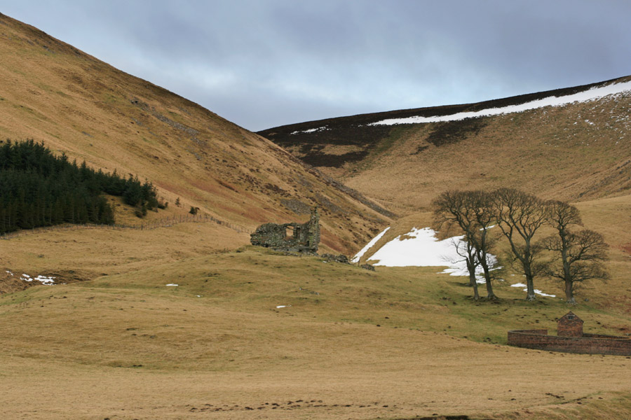
Hirendean Castle is a ruined 16th century peel tower probably built by the Kerr family.
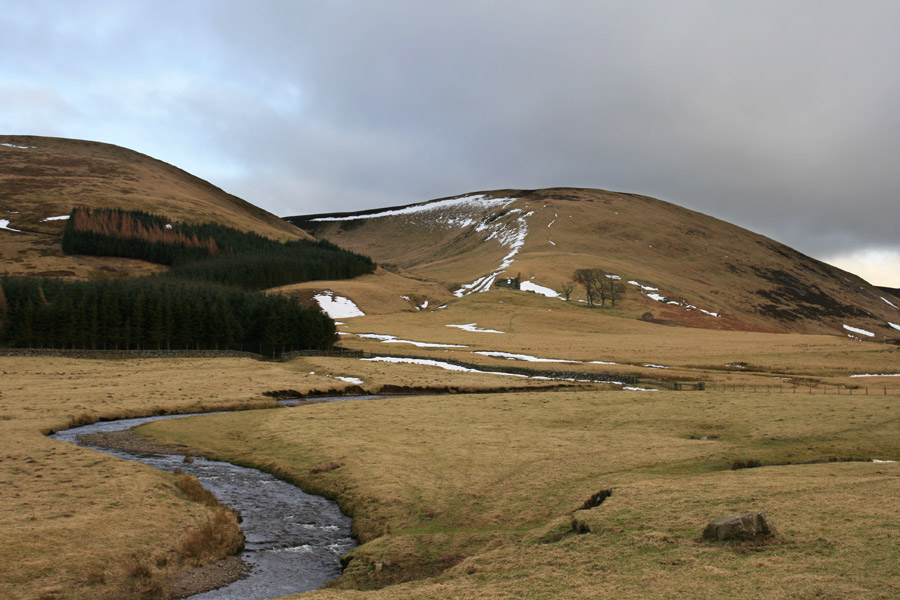
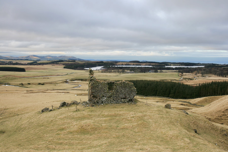
Situated on the flattened top of a raised mound beside the Hirenden Burn, it is further protected by the River South Esk running to the west of it, and occupies a good defensive position when approached from the south, although it is overlooked by the Moorfoot Hills to the north.
The castle stands on the lands of Moorfoot which were granted by David I to Cistercian monks from Melrose by in 1140. They built a grange at Moorfoot which seems to have been the focus of the estate until the Reformation when it became the property of Mark Kerr, the Abbott of Newbattle. Given the suggested date of the mid-16th century which is given for Hirendean Castle, it seems likely that the Abbott was responsible for building the castle.
There is an old local legend that refers to a castle at Hirendean in the mid-15th century, so, if true, it may be that the present building replaced an earlier structure.
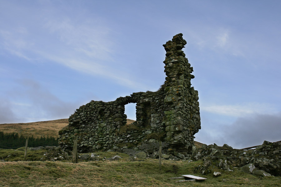
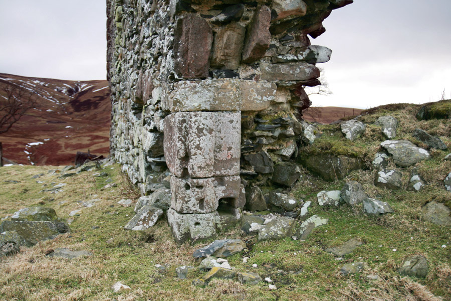
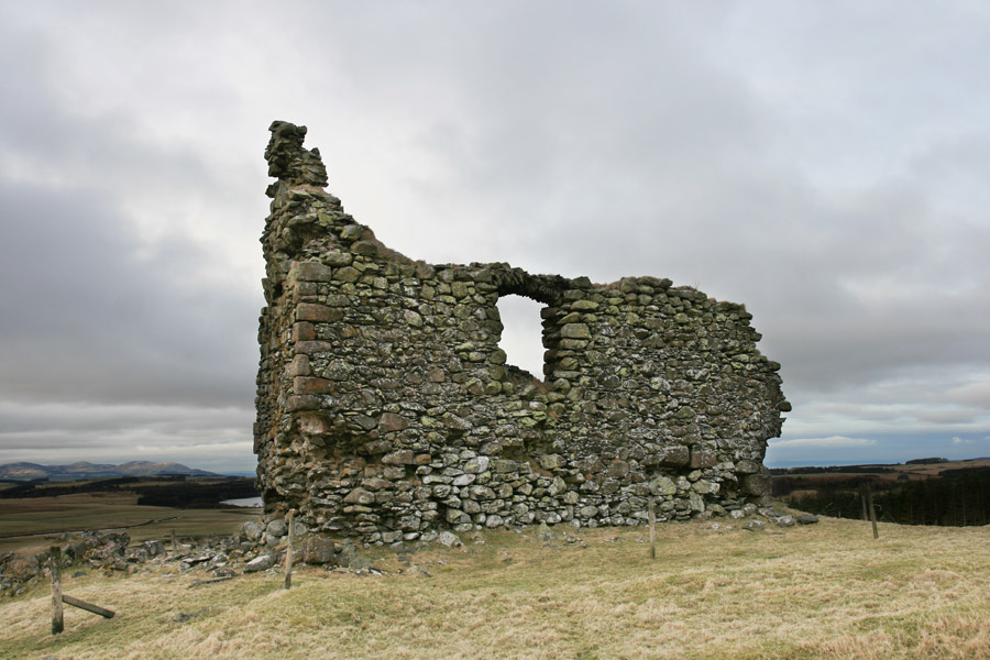
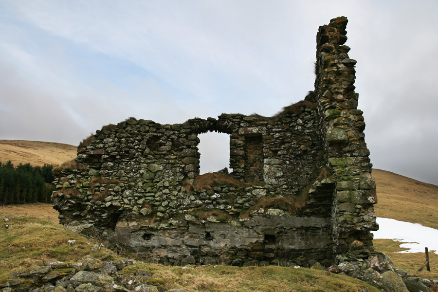
Originally measuring around 13.0m approximately east to west by around 7.5m north to south, it was quite a substantial building with walls 1.1m thick, and stood three storeys in height. A doorway at the east end of the south wall gave access into the basement level, and part of its carved surround can still be seen.
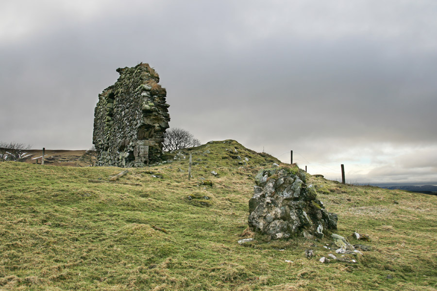
The east end of the castle is now missing, although a pile of rubble indicates where it has gone, and a large chunk of masonry evidently fell off the east gable and rolled down the hillside towards the Hirenden Burn.
The south wall still stands for most of its length, with a large window opening at first floor level. Part of the west gable joins the south wall at the south-west corner and stands to a height of around 9.0m.
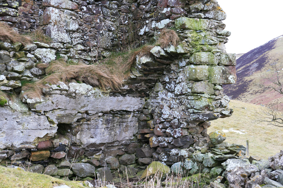
The basement was vaulted, and part of the arch can still be seen within the angle between the south and west walls. Square holes in the wall below the vaulting suggest that the basement was split into two levels by a wooden floor. The footings of the north wall can be identified amongst rubble in front of the castle’s interior.
Internally, to the west of the window is a tall rectangular niche, although what it was for is unclear, possibly just storage of some kind.
To the south of the castle is an area of flat ground on the summit of the mound which is covered in linear earthworks, which may perhaps represent the footings of ancillary buildings.
Mark Kerr was succeeded by his son, also Mark Kerr, who in 1606 would be created the 1st Earl of Lothian in 1606, following a spell as interim Lord Chancellor of Scotland. The 1st Earl’s main residences were Prestongrange and the grange of Moorfoot to the north of Hirendean.
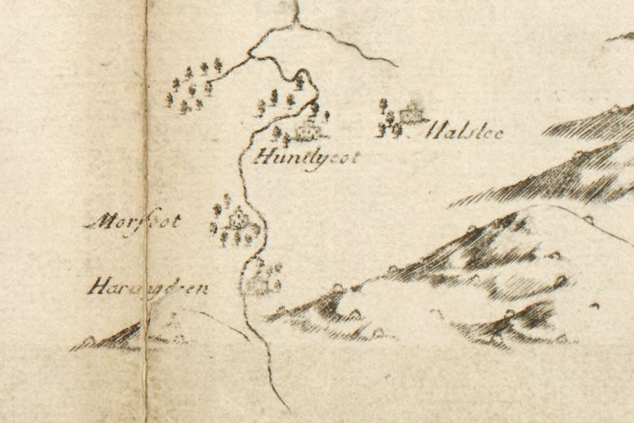
Hirendean Castle is marked on an 18th century reprint of a John Adair map from 1682 as the tower of Haringdren.
A Map of Midlothian / survey’d by Mr. J. AdairRichard Cooper, Edinburgh, c.1735map image courtesy of NLS
When Hirendean Castle fell out of use is unclear, however a book written in 1908 describes the castle as having been occupied within living memory, and goes on to state that the “arches of the roofs, stair-cases, and barred doors can still be traced”, suggesting a rapid decline in more recent years.