Gorrenberry Tower
Gorrenberry Tower belonged to the Elliot family in the 16th century and the Scott family in the 17th century.
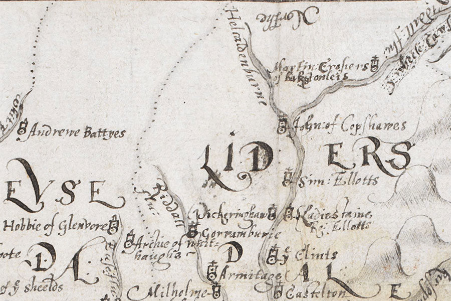
The castle is marked as “Gorramburie” on a map of 1590 which appeared in “An atlas of England and Wales, made by Christopher Saxton”, a book owned by William Cecil, 1st Baron Burghley, and commonly referred to as The Burghley Atlas.
The last remains of the tower were removed in the first half of the 19th century and the stones used to build farm offices. A slight rectangular mound marks the likely site of the tower.


Alternative names for Gorrenberry Tower
Goramberye; Goranbery; Goranberry; Gorenberie; Gorenberrie; Gorinberrie; Goringberrie; Gorramburie; Gorranberry; Gorremberry; Gorrenberrie; Gorrinberrie; Gorrinberry; Gorronberrie; Gorrumbarry; Gorrumberrie; Gorumberie; Gorumberrie; Gorumberry; Gorumbery; Gouinbery