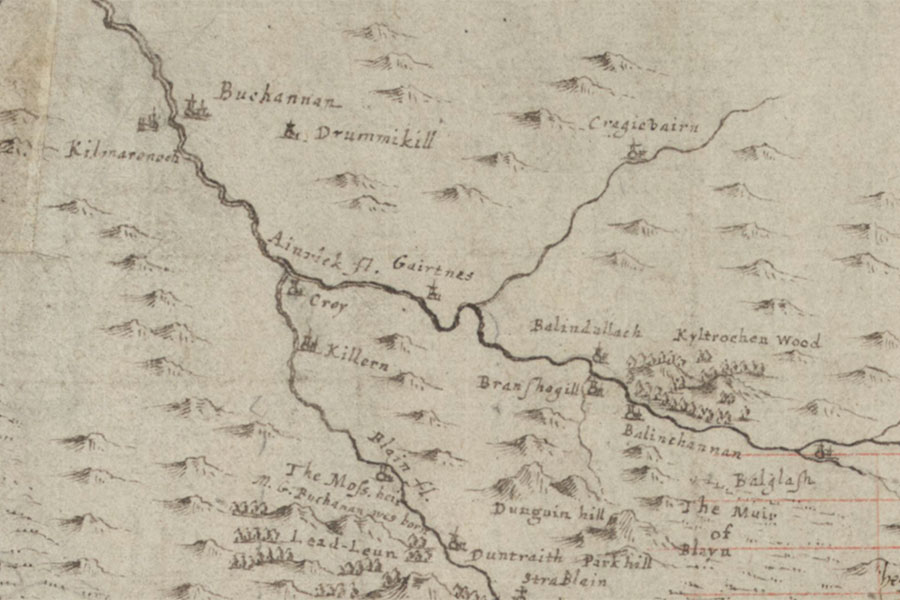
Gartness Castle
Pont 32 (The East Central Lowlands (Stirling, Falkirk & Kilsyth))
Timothy Pont, c. 1583-96image courtesy of NLS
Timothy Pont, c. 1583-96image courtesy of NLS


Alternative names for Gartness Castle
Gairtnes
Where is Gartness Castle?
Gartness Castle is in the parish of Drymen and the county of Stirlingshire.
Grid reference:NS 5025 8652
Lat / long:56.04805100,-4.40583730