Fintry Castle
Fintry Castle is a ruined 15th century castle which belonged to the Graham family.
Occupying a good defensive position on the lower slopes of the Fintry Hills, high above the Endrick Water, the castle is thought to have been built by Sir Robert Graham of Balargus or Ballargus. The estate of Fintry was given to him by his nephew Patrick, Lord Graham, in 1460, so it is likely that the castle was built in the second half of the 15th century.
Balargus was a property in Angus owned by the Grahams. It’s location is now lost but it might be somewhere near Claverhouse. John Graham of Balargus, the second son of Sir Robert, was the ancestor of the Grahams of Claverhouse and Duntrune.
Whether or not there was a castle here prior to that built by Sir Robert is unknown. Further along the glen to the west is Fintry motte which is thought to have been owned by the Grahams some time after the late 13th century. It seems possible that Fintry Castle might have been built to replace Fintry motte.
Fintry motte, Fintry Castle and Sir John de Graham’s Castle are arranged in an almost straight line running west to east. It was apparently possible to see Sir John de Graham’s Castle from Fintry Castle prior to the planting of the forest which now surrounds it.
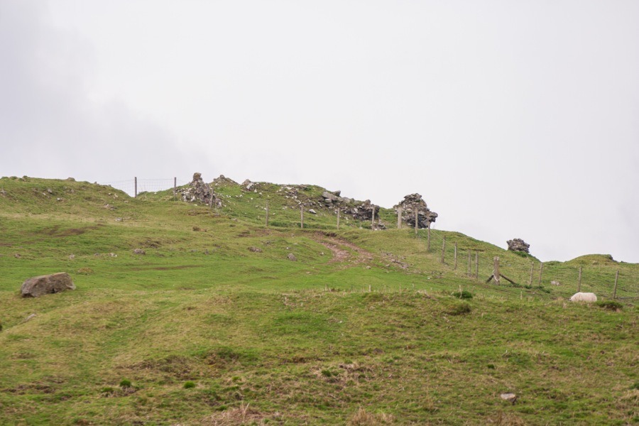
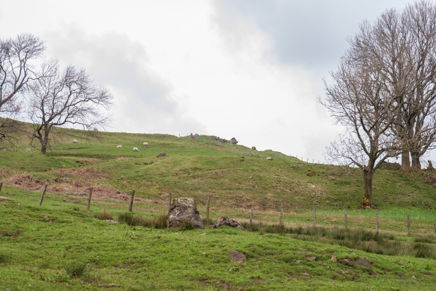
The stone for the castle was taken from immediately to the south of it, a linear rock-cut ditch providing both stone and extra protection from attack. It was aligned approximately east to west and measured around 14m long by around 8.4m wide with walls around 1.8m thick. There are traces of a courtyard wall on the north and east sides and a possible tower to the west.
Fintry Castle passed through several generations of the Graham family and in the 17th century they exchanged their lands here with the Duke of Montrose, also a Graham, receiving land near Dundee. The Grahams took the name Fintry with them naming their new property Fintry Castle (also known as Mains of Fintry Castle and now as Mains Castle).
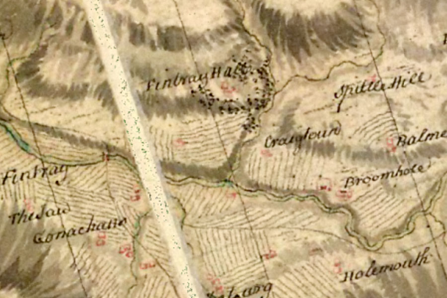
By 1724 the original Fintry Castle was referred to as the “old ruinous Tower of Fintrie” but it still appeared on Roy’s mid-18th century map of the Lowlands as Fintray Hall.
The lands of Fintry, including Fintry Castle, were owned by the Duke of Montrose until the 19th century when the family sold up and emigrated to South Africa. Stone from the castle was used in the building of dykes and farmhouses in the surrounding area and today the fragmentary ruins of Fintry Castle stand within an agricultural field. A section of the north wall measures around 12m in length by around 1.3m in width and up to 1.3m in height but the rest of the walls have fallen and been robbed.


Alternative names for Fintry Castle
Fintray Hall; Fintrie; Fyntrie; Graham's Castle; Tower of Fintrie