Eckford Tower (site of)
Eckford Tower was a tower which belonged to the Scott family although nothing of it now remains.
By the mid-13th century the barony of Eckford consisted of a large swathe of land bounded by the Teviot to the west and the Kale to the north and east and was owned by Geoffrey of Ekkeford, better known as Sir Geoffrey de Mowbray, Justiciar of Lothian. His son, Richard, paid homage to Edward I of England in 1296.
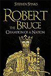
Sir Geoffrey died in 1300 and was succeeded by his third son, Sir Roger de Mowbray, however Sir Roger was involved in a plot to kill Robert the Bruce and replace him as King with William de Soules, Lord of Liddesdale. He was wounded during his arrest in 1320 and died in prison while awaiting trial.
Sir Roger’s extensive estates were forfeited to the Crown, and Robert granted the manor of Ecford to Walter, Steward of Scotland, the husband of Marjory Bruce. In 1326 the King gave £2000 Sterling for the rebuilding of Melrose Abbey following its destruction by the English in 1322. The money was primarily raised from the baronies of Cessford and Eckford which Sir Roger de Mowbray had forfeited, and the lands of Nisbet, Longnewton, Maxton and Caverton which William, Lord Soules, had forfeited.
The tower was attacked by the English numerous times during the 16th century.


Alternative names for Eckford Tower
Ecford; Eckeforde; Eckford-tower; Ekkeford; Hecfurde; Hekfurde