Eaglescairnie
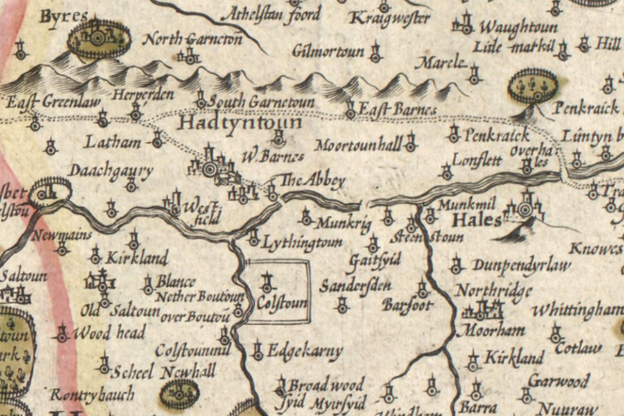
A new description of the shyres Lothian and Linlitquo
Hendrik Hondius, Amsterdam, 1630map image courtesy of NLS
Hendrik Hondius, Amsterdam, 1630map image courtesy of NLS


Alternative names for Eaglescairnie
Eaglescairnie House; Edgekarny
Where is Eaglescairnie?
Eaglescairnie is in the parish of Bolton and the county of East Lothian.
Grid reference:NT 51882 69467
Lat / long:55.915875,-2.771409