Dunkeld House
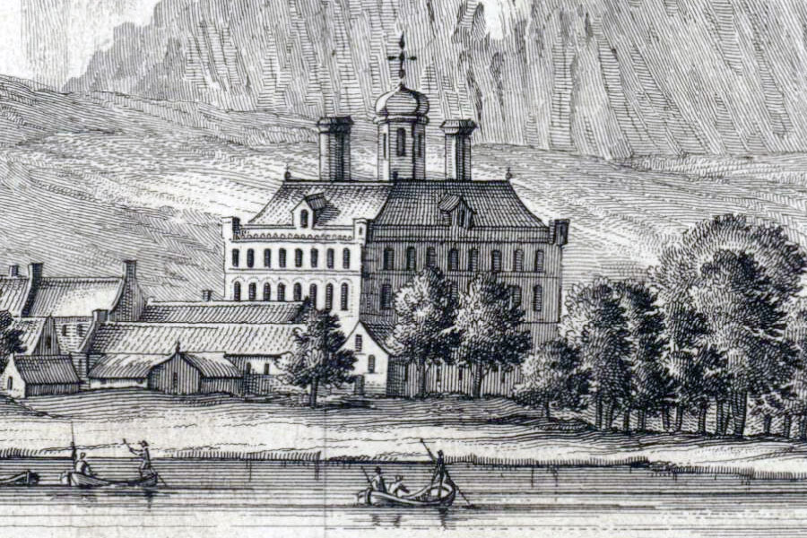
Theatrum Scotiae, John Slezer, 1693
Dunkeld House was the home of the Earls of Atholl from before 1529 and was rebuilt in the 17th century by Sir William Bruce, although nothing of it now remains.
I have included the original Dunkeld House here as, given its age, it seems likely that it would have been fortified. However since little seems to be known about the early building, and no part of it still exists, it will have to remain as speculation for now.
A history of the Dunkeld House Hotel states that Old Dunkeld House was the traditional home of the Earls of Atholl since before 1529. This appears to be confirmed by the Tayside and Fife Archaeological Committee who refer to Dunkeld House as being 16th to 17th century in date. Whatever its age, it is known to have stood to the north of the cathedral.
Cromwell’s troops laid siege to Dunkeld House in 1653 or 1654 then blew it up, leaving it a ruin. It was rebuilt between 1676 and 1684 by Sir William Bruce, who had been commissioned by John Murray, 1st Marquess of Atholl. It has been described as Bruce’s first commission for a new building, although several sources state that the old house was rebuilt suggesting that it may have been incorporated into the new building.
Bruce’s Dunkeld House, which is depicted on a 1693 sketch of Dunkeld by John Slezer, consisted of a large rectangular main block aligned approximately north to south. Three storeys and an attic level in height, its walls were pierced by numerous windows. At each corner of the wall heads is a small bartizan. A single dormer window on each side of the house let light into the attic level, above which was a flat roof crowned by two massive chimney blocks and a central tower with onion dome.
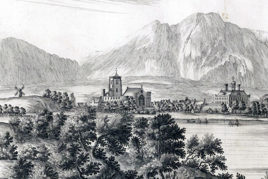
Theatrum Scotiae, John Slezer, 1693
During excavation work at NO 025 426 in 1994 the footings of a 17th century tower which is thought to have once contained a library. Whether this was part of Bruce’s building or an earlier structure is unclear.
Dunkeld House can be seen in the background of a painting of John Murray, 1st Duke of Atholl, painted by Thomas Murray in 1705, which hangs in Blair Castle. In 1730 gates were cast for the entrance to Dunkeld House. These were moved to their current location at the entrance to Dunkeld Cathedral in 1832. Frederick, the Prince of Hesse, stayed at Dunkeld House in 1746 while in command of a 100-strong force of mercenaries in the service of the government. The house gave its name to a jig written by Niel Gow in the 1770s for his patron John Murray, 3rd Duke of Atholl, and first published in 1784.
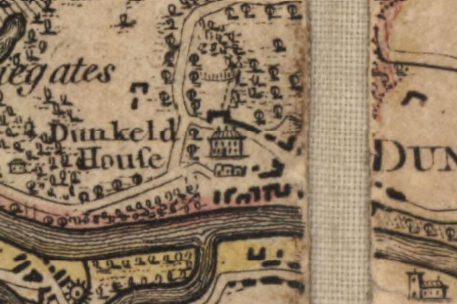
James Stobie, London, 1783
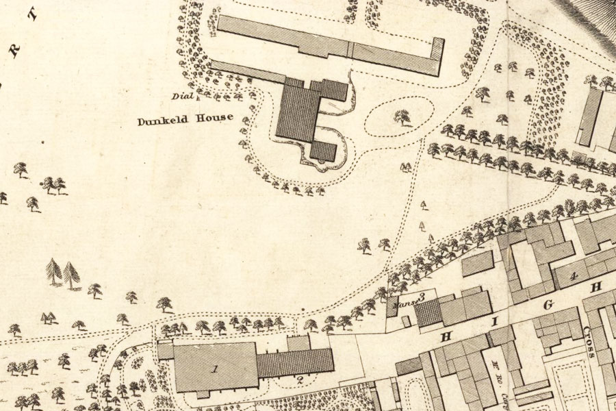
John Wood, Edinburgh, 1823
Dunkeld House was demolished in 1827, and a new house was started in 1828 on parkland to the west of the cathedral. However following the 4th Duke’s death in 1830 building work stopped and the new house was never completed (it was demolished later in the 19th century). The present Dunkeld House, even further west and now run as a hotel, was built between 1899 and 1901 by the 7th Duke.
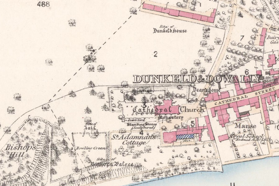
Ordnance Survey, 1867


Alternative names for Dunkeld House
Old Dunkeld House
Where is Dunkeld House?
Dunkeld House is in the parish of Dunkeld and Dowally and the county of Perthshire.
Grid reference:NO 024 427
Lat / long:56.566237,-3.58963