Drumelzier Castle
Drumelzier Castle is a ruined 16th century tower house, although it has older origins.
It is thought that the first castle at Drumelzier was built by the Frasers of Oliver, who owned it as early as the 12th or 13th centuries. The first Fraser to be described as of Drumelzier is Adam Fraser of Drumelzier and Hales, the son of Udard Fraser.
During the first quarter of the 14th century the daughter and heiress of Adam’s son Laurence Fraser of Oliver married Roger de Twydyn or Twedyn (Tweedie), and Drumelzier Castle, along with Tinnis Castle, passed into the Tweedie family. A charter from 1325 confirms the grant from William Fraser to Roger de Twydyn of the barony of Drumelzier.
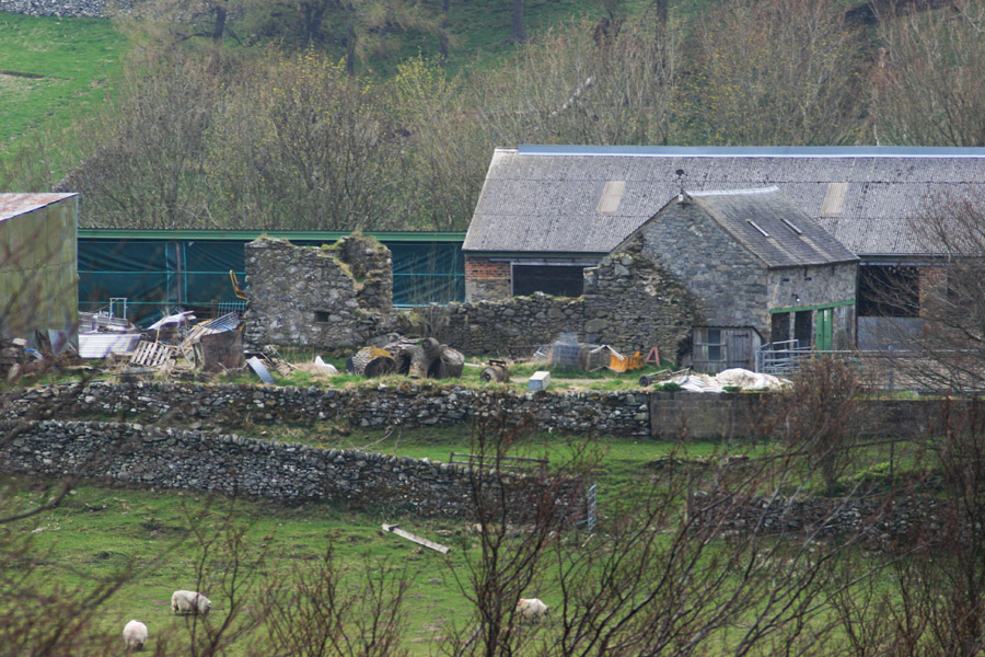
Of the early castle only a corner section remains, consisting of walling around 1.0m thick, and incorporated into a more modern farm building. In the mid-16th century a three storey rectangular wing was added to this main block, measuring around 6.7m by around 6.4m, with walls over 1.2m thick, projecting from the east end of the south wall.
Then in the 1580s a small square tower was added to the south-east corner of the wing. It measures around 4.8m square, with walls approximately 1.1m thick. The tower had a vaulted basement with gunloops in the west, south and east walls. There was no external access to the basement level, which was entered from the first floor via a hatch.
Rising to a height of three storeys plus an attic within a gabled roof, a drawing from 1791 shows the tower had a bartizan at roof height on the south-west corner. Each of the windows on the first, second and attic floors has a shot hole under its sill.
In 1524 John Tweedie of Drumelzier was involved in the murder of John, 2nd Lord Fleming, along with a group of Tweedies, including Thomas Tweedie of Oliver Castle, James Tweedie of Kilbucho and James Tweedie of Wrae.
This was part of a long running feud between the Flemings and Tweedies, and led to the Tweedie property of Tinnis Castle being destroyed with gunpowder by the 2nd Lord Fleming’s son, Malcolm, 3rd Lord Fleming.
The Tweedies also had a long feud with their neighbours the Veitch family of Dawyck during the 16th and 17th centuries.
In the late 16th century James Tweedie of Drumelzier married Margaret, daughter of Sir James Anstruther of Anstruther.
In 1632 or 1633, due to declining fortunes, the Tweedies were forced to sell Drumelzier to John Hay, 8th Lord Hay of Yester. Drumelzier Castle is still owned by the Hay family, the present laird being styled Alexander Hay of Duns and Drumelzier.
Drumelzier Castle is thought to have been occupied until the early 18th century, when a new house, Drumelzier Place, was built around 45m to the north-east. Presumably after it was abandoned it fell into disrepair, and a drawing from 1791 shows it as a substantial but roofless ruin.
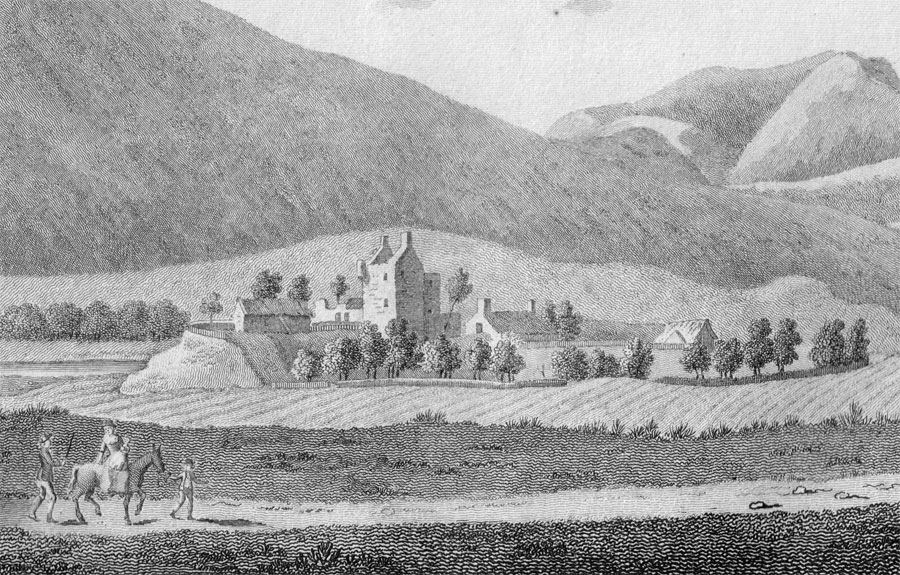
Francis Grose, 1797
It now stands within the agricultural buildings of Drumelzier Place Farm, which were presumably built with stone from the castle over the years. By 1962 only the corner of the original main block remained, standing to a height of over two storeys, while just the east wall of the projecting wing stood to three storeys in height.
The tower stood to its original height as late as 1972, however due to safety concerns it was largely dismantled and today only the ground floor of the tower still stands, with a low section of the projecting wing’s east wall and a two storey high corner section of the oldest section.


Alternative names for Drumelzier Castle
Drumailler Castle; Drummelzier Castle