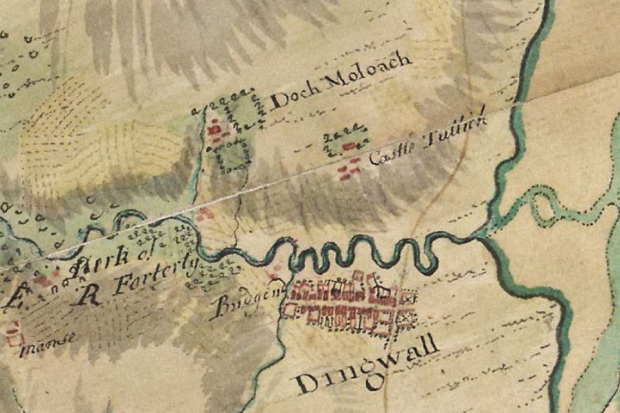
Dochmaluag House
Alternative names for Dochmaluag House
Davochmaluach House; Doch Moloach
Where is Dochmaluag House?
Dochmaluag House is in the parish of Fodderty and the county of Ross and Cromarty.
Grid reference:NH 5198 5996
Lat / long:57.60528300,-4.47889620