Dawstonburn Tower
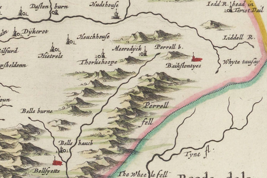
Lidalia vel Lidisdalia regio, LidisdailJoan Blaeu, Amsterdam, 1654map image courtesy of NLS
A tower named Dastenburn is marked on Blaeu’s mid-17th century map of Lidalia but little seems to be known about the property.


Alternative names for Dawstonburn Tower
Dastenburn
Where is Dawstonburn Tower?
Dawstonburn Tower is in the parish of Castleton and the county of Roxburghshire.
Grid reference:NY 5636 9666
Lat / long:55.26216,-2.6882251