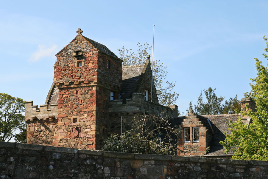
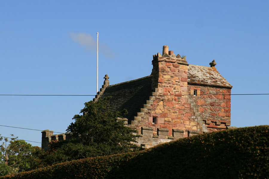
Darnick Tower
Darnick Tower dates back to the 15th century, and was owned by the Heiton family for centuries.
The first Darnick Tower was built around 1425 by the Heiton family, after they were granted land at Darnick by James I. The Heitons had their origins in Normandy.
Following the Battle of Ancrum Moor in 1545, Darnick Tower was attacked and partly destroyed by the retreating English army led by the Earl of Hertford. A new charter of the lands of Darnick were granted to an Andrew Heiton, or De Heyton, by Mary Queen of Scots and Lord Darnley in 1566, and the tower was rebuilt in 1569.
The tower is a three storey tower house aligned approximately east to west, measuring around 9.1m by around 6.7m north to south. Projecting from almost the middle of the south wall is a tall square stair tower. The entrance is via a door at ground level in the east side of the stair tower.
The basement level was originally vaulted and contained the kitchen, with a fireplace on the west wall. However the vaulting apparently collapsed in the 1780s and was removed, the walls of the kitchen then being made square.
On the first floor is the main hall, taking up the entire floor and measuring around 6.9m by 4.3m, with a large fireplace on the west wall. The second floor is divided into two bedrooms, with the eastern chamber featuring a shot hole below the window in the south wall covering the entrance below.
The spiral staircase continues all the way up to the parapet level, where it gives access to a crenelated parapet walk supported on corbels. Within the walkway rises an attic level with crowstepped gables, the doorway of which is on the east side of the walkway.
Also accessed from the parapet is the caphouse on top of the stair tower. A smaller spiral staircase climbs up within the thickness of the north wall of the stair tower, and into the caphouse. The caphouse is floored with stone, supported by a vaulted stairhead below, and has a vaulted ceiling supporting a stone roof.
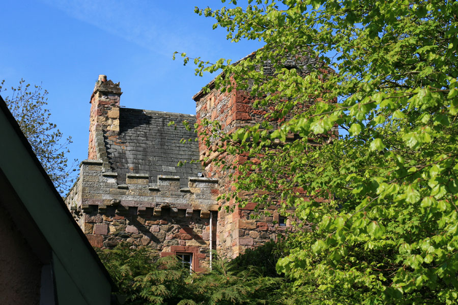
It seems possible that this stair tower was added to the old tower house in 1569, as a carved stone lintel carries that date, the initials AH and KF for Andrew Heiton and his wife Kate Fisher, and IHS signifying Iesus Hominum Salvator, or Jesus the Saviour of Man. A carved panel high on the south wall of the stair tower shows the arms of the Heiton family.
The Fishers of Darnick are said to have been responsible for building Fisher’s Tower at the bottom of the garden of Darnick Tower. These were two of the three castles in the village of Darnick, the third being the now gone Little Peel.
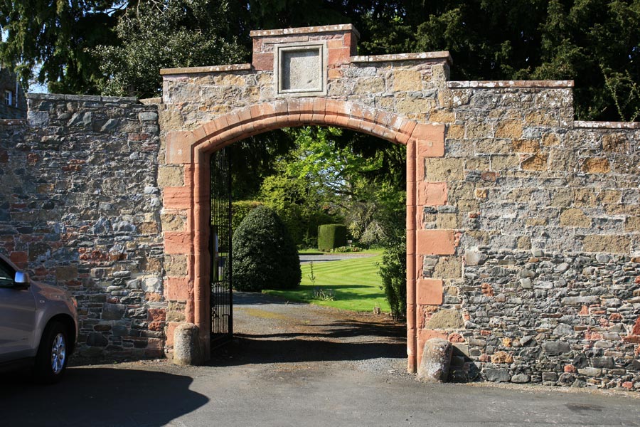
The property is surrounded by a high wall, in the south side of which is a large arched entrance.
Little mention seems to be made of Darnick Tower through the 17th and 18th centuries, although it is known to have still been owned by the Heiton family during this time.
Another Andrew Heiton, an architect from Perth, inherited Darnick Tower in 1865, and set about restoring it over the following two years. In 1869 a new wing was added to the east side of the main tower, consisting of two storeys and an attic in a gabled roof.
As late as 1986 Darnick Tower was still owned by the Heiton family, although I’m not sure if that is still the case as it was apparently run as a museum and a guest house before returning to use as a private residence.