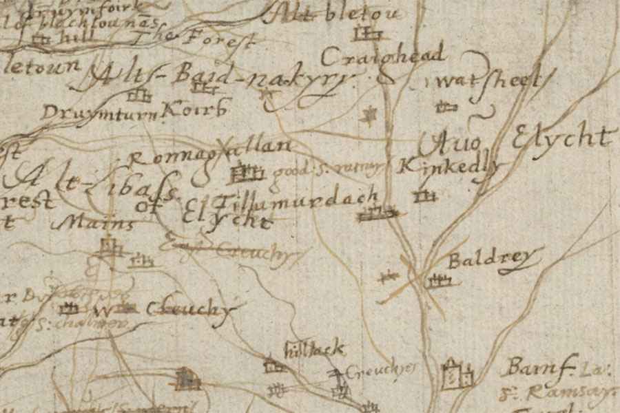
Corb


Alternative names for Corb
Corb Castle; Koirb; Korrb
Where is Corb?
Corb is in the parish of Alyth and the county of Perthshire.
Grid reference:NO 1648 5682
Lat / long:56.695653,-3.365291
Corb Castle; Koirb; Korrb
Corb is in the parish of Alyth and the county of Perthshire.
Grid reference:NO 1648 5682
Lat / long:56.695653,-3.365291

Enter a starting point


