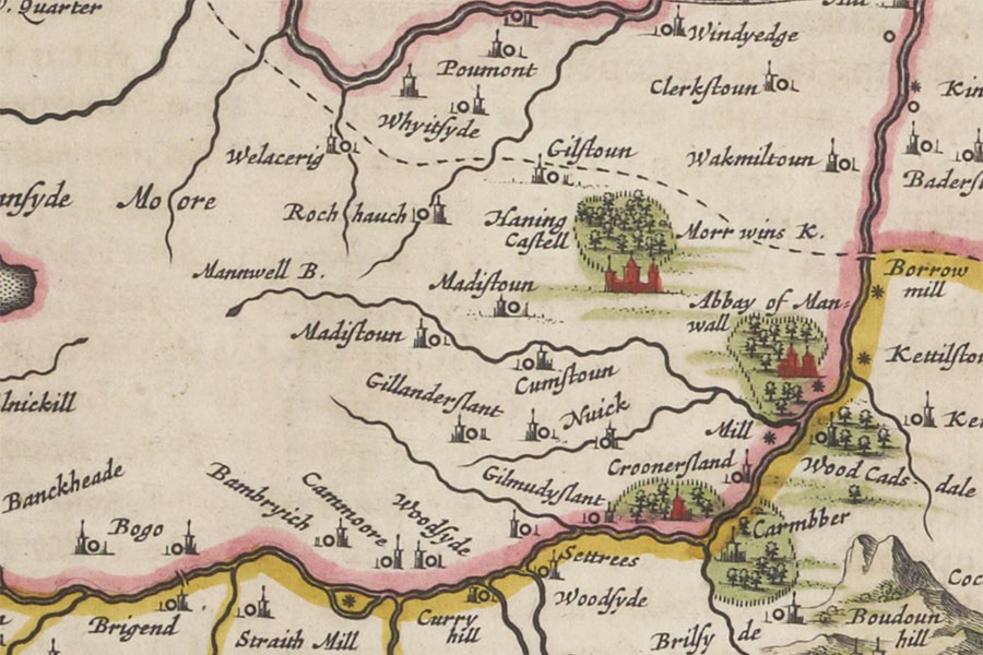
Compston
Joan Blaeu, Amsterdam, 1654image courtesy of NLS
Compston House is a mid-18th century laird’s house which may have replaced an earlier castle or old house.
The earlier building is likely to have superseded Castlehill motte around 300m to the south.
In June 1496 James IV granted to John Lindsay the lands of Cummistoun, alias Manwell-rig, with its mill known as “le Walkmyll”, and the lands of le Powis de Erth, with its grain mill, known as “le Cornemyll”, which had been inherited by the King by right of succession as heir of his late grandmother, Mary of Guelders.
The same lands were in April 1502 granted by the King to the prebendaries and chaplains of the Trinity Collegiate Church in Edinburgh, which had been founded by his grandmother, annulling all previous charters regarding these lands.
Fragments of 16th century carved mouldings are built into farm buildings adjacent to the laird’s house.


Alternative names for Compston
Campston; Campstoun; Compstone; Cummistoun; Cummystoun; Cumstone; Cumstou~; Cumstoun; Old Compstone Castle