Castle Hill
Only a motte, standing on a large, flat-topped natural knoll survives here, with no stone remains.
The site is situated on a wide promontory, defended to the north by the River Brora and to the south and east by the North Sea. The motte is at the north-west corner of the knoll, with the knoll itself probably forming a surrounding bailey. The land to the south may once have been marshland, and may have been entirely surrounded by a loop of the River Brora.
The motte is quite small, measuring around 10m in diameter, and only rising to a height of around 1.0m above the knoll on which it stands. To the north and west the motte’s slopes continue into those of the knoll, offering considerable protection, and to the south and east a ditch has been dug, around 0.8m deep by around 7.0m wide.
The knoll is considerable in size, measuring around 150m east to west by around 40m north to south, and rising 8.0m above the surrounding flood plain of the River Brora. If the entire area of the knoll had been enclosed as a bailey then that was suggest that it was an important site.
Located as it is in the parish of Clyne, it is tempting to suggest that this was the site of an earlier castle of Clyne. However it should be pointed out that there is very little in the way of written history or oral tradition concerning Castle Hill.
Since motte and bailey castles were largely superseded by other designs around the end of the 13th century, it is likely that any castle here fell out of use around that time, and was abandoned for another site. Interestingly the church at Clyne is first mentioned in records from the 13th century.
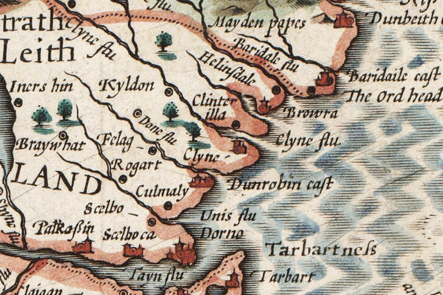
Old maps from the 16th and 17th centuries show a castle named Clyne, and appear to site it in between two rivers, the more northerly of which is the River Brora, and on the opposite bank to the town of Brora. This might suggest that the castle of Clyne was on the promontory on which Castle Hill stands.
However the same maps are full of mistakes and discrepancies, so it is difficult to rely on them for exact locations. Maps from later in the 17th century almost exclusively show a castle named Clyne to the north of the River Brora, suggesting that if there ever had been a Clyne Castle at Castle Hill, it had certainly been superseded by this time by the one at Clyne.
Joan Blaeu’s map of Southerlandia (Sutherland) from 1654 shows a castle at Brora south of the river, nothing at Castle Hill, and two castle-like symbols named “Clyn K” in close proximity to one another north of Brora. These perhaps signify the church at Clynekirkton with the castle of Clyne.
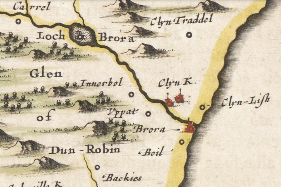
Blaeu Atlas of Scotland, 1654
Neither Clyne nor Castle Hill are marked on Roy’s map from the mid-18th century (although Clynelish is), however an estate plan of the Farm of Doll from 1772 shows the Castle Hill, marked as “Knock Castle” with the land to the south of it named “Pool of the Doll” perhaps suggesting marshy origins. Any trace of a castle had obviously gone by this point in time.
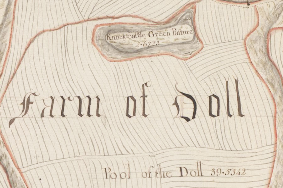
John Kirk, c.1772
By the time of the Ordnance Survey maps of the 1870s the site is marked as “Castle Hill”.
Due to the lack of evidence it is impossible to be certain about the history of Castle Hill. If it is indeed the remains of a motte and bailey, the lack of documentary references to it would suggest that it was abandoned at an early time.
Whether or not this was due to the focus switching to a new castle at Clyne across the River Brora is unknown, as is whether Castle Hill had any connection to Clyne at all.


Alternative names for Castle Hill
Knock Castle
Where is Castle Hill?
Castle Hill is in the parish of Clyne and the county of Sutherland.
Grid reference:NC 8952 0369
Lat / long:58.008656,-3.871356