Castle Greg
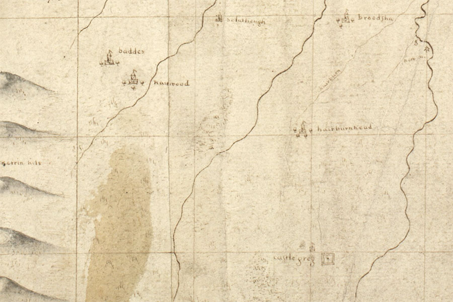
John Adair, c.1682map image courtesy of NLS
Castle Greg is mentioned in a land charter of 1512 and is marked on maps of 17th century maps, however the scale and accuracy of those maps is such that it is difficult to plot an accurate location for the castle if it even existed.
A tower symbol is marked on Adair’s map of c.1682 immediately to the north-west of the Roman fort which is illustrated as concentric squares. The name Castle Greg is written between them which makes it unclear if the name applies to just the fort or to both the fort and the tower.
If the positioning of the tower is relatively accurate then it places it somewhere near the summit of Camilty Hill, a slight eminence rising 2m higher than the fort.
Around 230m to the north-west of the fort is an enclosure measuring around 12.2m in internal diameter and surrounded by an earth bank approximately 0.6m tall which has a collapsed width of around 3.7m. On the south side is an ill-defined entrance around 4.0m wide. Around this bank is a second lower earthen ridge averaging around 3.1m in width and broken on the north-east side.
This enclosure has been variously interpreted as a hexagonal possible Roman shrine and as a circular sheepfold, although this latter feature was said to be 91m to the north-west of the fort.
I have listed Castle Greg as a possible castle pending further research.


Alternative names for Castle Greg
Castelgreg
Where is Castle Greg?
Castle Greg is in the parish of Mid Calder and the county of Midlothian.
Grid reference:NT 04872 59478
Lat / long:55.819160,-3.519783