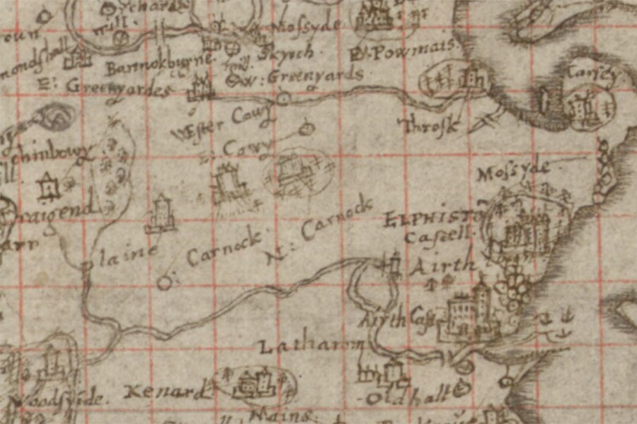
Bruce's Castle


Alternative names for Bruce's Castle
Carnock Tower; O. Carnock; Over Carnok; Over Carnock
Where is Bruce's Castle?
Bruce's Castle is in the parish of St Ninians and the county of Stirlingshire.
Grid reference:NS 85706 87805
Lat / long:56.0693730,-3.8375161