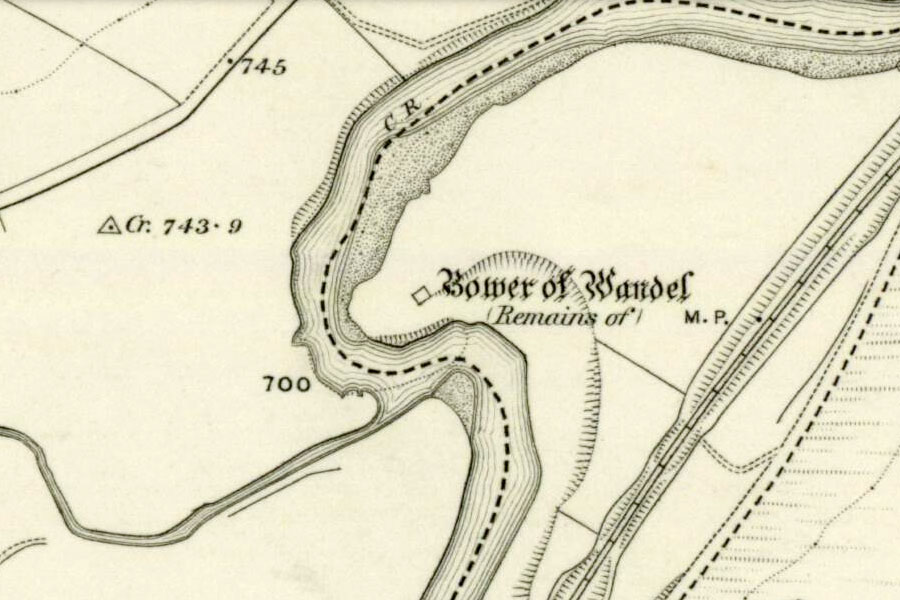
Bower of Wandel
Ordnance Survey, 1864
The remains of Bower of Wandel, a ruined 15th century castle, stand on a mound within a bend in the River Clyde.
Despite being overlooked on all sides by hills the castle occupies a good defensive position on a rocky promontory jutting out into the River Clyde, which curves around it on almost three sides. The location is an important strategic one, situated on a valley floor which served (and stills serves) as a main route from north to south.
The castle sits within a plot of around 30 acres known as Bower Park, which contains several other earthworks to the north-east, east and south-east. Some of these features have been identified as glacial moraine knolls, however the to the south-east may have been modified to form a bank for use as a possible siege work.
The fact that there is a motte suggests that this site is contemporary with several other mottes which are located along the same route, such as Coulter, Roberton, Abington, probably giving it a 12th century origin.
Some sources state that the Jardines owned the Bower of Wandel, along with the barony of Wandel, from the 12th century until the 17th century. However the New Statistical Account mentions that the barony belonged to the See of Glasgow in 1116, when it was known as Quendal, and that a William de Hertisheved or William de Hartside, who was the sheriff of Lanark in 1255, held the barony during the reign of Alexander II. It goes on to state that the ownership passed to William de Gardin or Jardin, the ancestor of the Jardines of Applegirth, during the reign of David II (1329 – 1371). The names Hartside of Wandel seem to have been interchangeable and referred to the same barony.
The castle is roughly square in plan, measuring approximately 13.5m south-west to north-east by 10.1m south-east to north-west, and is thought to date to the 15th century. It would likely have replaced or incorporated an earlier stone structure which itself would have superseded a timber tower. The surviving walls stand to an average height of around 2.0m, and consist of a rubble core with facing stones averaging around 2.5m thick. Many of the facing stones are no longer in situ, having either been robbed for other uses or dislodged by cattle rubbing against them.
The east corner of the tower is missing, which may suggest that this was the site of an entrance of some description and possibly a staircase. The basement was vaulted, the springing for the vault still being visible on the north-west wall. The bases of three internally-splayed slit windows also survive in the south-east, south-west and north-west walls.
A tradition states that James V had a mistress at the Bower of Wandel, or may have used it as a hunting lodge.
As previously mentioned the Jardines held the castle until the 17th century. In 1613 it was acquired by William Douglas, 1st Marquess of Douglas and 11th Earl of Angus, and his son Archibald (created Earl of Ormond in 1651), and remained in the Douglas family until at least 1845 (when the New Statistical Account). I haven’t been able to ascertain who currently owns the castle, however it may have stayed with the Douglases and be part of the Douglas-Home family’s Douglas and Angus Estates which owns land in the surrounding area.


Alternative names for Bower of Wandel
Hartside; Hertisheved; Quendal; Wandel Tower; Wandel's Bower; Wendal