Blacket House
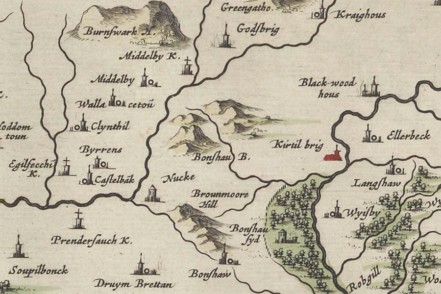
Joan Blaeu, Amsterdam, 1654map image courtesy of NLS
Blacket House is a ruined 16th century tower house which belonged to the Bell family.
Towards the end of the 16th century the Bells of upper Kirtledale were in a conflict with the Irvings of lower Kirtledale. It’s possible that this may have been in regard to the shooting of Fair Helen of Kirkconnel.
Helen was said to have been the daughter of the laird of Kirkconnel and had two suitors. One is said to have been Adam Fleming of Fleming Hall while his rival may have been Robert Bell of Blackethouse. An attempt was made on Fleming’s life but Helen intervened and was shot instead. Over the years the details of the story have become confused and the surnames of the three characters are interchangeable between versions.
Blacket House is marked on Blaeu’s mid-17th century map, based on Pont’s late 16th century work, as a tower named Black-wood hous.


Alternative names for Blacket House
Black-wood hous; Blacket Tower; Blacket-house; Blackethouse; Blackwood House; Blackwood Tower