Witch's Stone
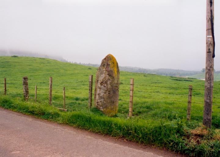
The Witch’s Stone sits by the road to Meikle Obney farm, just behind the fence-line of a grassy field. It is shielded to the NW by a small hill about 50m away, and is on the edge of the Obney Hills which seperate the farmland of this area from Strathbraan. It is seperated to the NE from the Staredam standing stones by a mere 1.0km and the valley of a small burn. The Witch’s Stone stands 2.2m tall, and is very upright, with a pointed top. It measures 1.5m broad by 0.7m wide, with a basal circumference of 3.5m.
The origin of the stone’s name is unclear, although there is a legend that the stone was being carried in the lap of a witch as she flew over Meikle Obney, but she dropped it and it has remained there ever since.


Alternative names for Witch's Stone
Meikle Obney
Where is Witch's Stone?
Witch's Stone is in the parish of Auchtergaven and the county of Perthshire.
Grid reference: NO 0424 3752
Lat / long: 56.51987762, -3.557240336
OS Map for Witch's Stone

Directions to Witch's Stone
Enter a starting point
Weather at Witch's Stone
max 7°C / min 4°C
1024mb
57%
16%
04:56 19:30
Few clouds
Weather observed at Bankfoot at 20:18


