Wester Tullybannocher
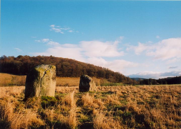
This is a beautifully-situated site, standing on the wide flood plain of the River Earn with views to the hills dividing Strathearn from Glen Lednock to the north and Glen Artney to the south.
Only two stones remain of what was probably an original four-poster (four stones were marked on the 1867 OS map). They stand on a slight circular mound which is clearly visible, the grass on the mound growing a different colour to the surrounding field. Around 1883 a third stone fell over and was removed. The western stone has at least four cup-marks incised on it.
The stones are 6.70m apart, and are 1.50m and 1.40m tall


Alternative names for Wester Tullybannocher
Comrie; Twenty Schilling Wood; Twenty Shilling Wood; Wester Tullybanocher
Where is Wester Tullybannocher?
Wester Tullybannocher is in the parish of Comrie and the county of Perthshire.
Grid reference: NN 7548 2247
Lat / long: 56.37754109, -4.017894384
OS Map for Wester Tullybannocher

OS Explorer map OL47
Buy from Ordnance Survey
Directions to Wester Tullybannocher
Enter a starting point

Weather at Wester Tullybannocher
max 10°C / min 9°C
1004mb
45%
89%
04:43 19:44
Overcast clouds
Weather observed at Comrie at 10:33


