Wester Enochdhu
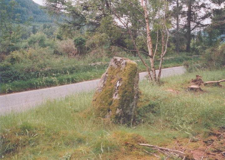
This 1.40m tall stone, to the SE of Woodend Cottage, stands just back from the main road on a slight bank. Although it is in amongst trees and bushes, it is easy to spot, but wasn’t always so. Coles visited here in 1908 and couldn’t find the stone, suggesting perhaps that the undergrowth was more overgrown back then.
Irregular in shape but with a flat N side, it has a triangular feel to it, although not as much as its near neighbour the Croft House stone. These two stones should perhaps be more properly thought of as a pair of stones rather than two individual ones. They are aligned NW-SE at a distance of approximately 400m from each other. As with other pairs of stones in Perthshire, this stone has a flat side, while the Croft House stone is a more rounded shape.
The stone leans to the N, while its top appears to point W to the summit of Ben Vrackie, visible rising over the horizon.


Alternative names for Wester Enochdhu
Enochdhu; Woodend; Woodend Cottage
Where is Wester Enochdhu?
Wester Enochdhu is in the parish of Moulin and the county of Perthshire.
Grid reference: NO 0600 6299
Lat / long: 56.7483737, -3.537243255
OS Map for Wester Enochdhu
Directions to Wester Enochdhu
Enter a starting point
Weather at Wester Enochdhu
max 12°C / min 9°C
1029mb
59%
93%
04:52 19:32
Overcast clouds
Weather observed at Milton of Edradour at 16:07


