Newhall Bridge
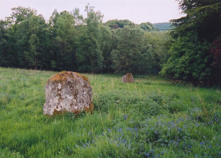
Just inside the gateway to Taymouth Castle, on a (natural) raised piece of ground beside the driveway, are the two Newhall Bridge standing stones. Both stones have been worked, with their inner faces having been smoothed down.
Separated by a distance of 16m, they are aligned NW-SE, which would seem to discount the theory that they might once have formed part of a circle. As with other Perthshire “two-posters”, one stone (the NW) is slab-like, while the other (the SE) is more square at the base.
Stone A – 1.42m tall.
Stone B – 1.47m tall.
The stones stand 16.30m apart.


Alternative names for Newhall Bridge
Taymouth
Where is Newhall Bridge?
Newhall Bridge is in the parish of Dull and the county of Perthshire.
Grid reference: NN 7926 4668
Lat / long: 56.59583741, -3.967613412
OS Map for Newhall Bridge

Directions to Newhall Bridge
Enter a starting point
Get directions


Weather at Newhall Bridge
3°C
max 3°C / min 3°C
max 3°C / min 3°C
5km/h NW
1029mb
69%
55%
04:54 19:34
1029mb
69%
55%
04:54 19:34
Broken clouds
Weather observed at Aberfeldy at 06:45
References (websites)
Ancient sites near Newhall Bridge
Castles near Newhall Bridge
Pictish stones near Newhall Bridge

Pictish sites near Newhall Bridge
Accommodation near Newhall Bridge
The Kenmore Hotel
2.3km away
Coshieville House
3.0km away
Aberfeldy Weem Hotel
5.8km away
Moness House Hotel & Country Club
7.6km away
Ben Lawers Hotel
13.4km away
Loch Tummel Inn
13.7km away
Ardeonaig Hotel and Restaurant
16.5km away
Dunalastair Hotel
17.8km away
Green Park Hotel
18.2km away
Cuil-an-Daraich Guest House
18.3km away
Accommodation search
Cafés, restaurants & bars near Newhall Bridge
House of Menzies
4.7km away
Aberfeldy Weem Hotel
5.8km away
The Watermill
6.7km away
Habitat Café
6.8km away
Dunalastair Hotel
17.8km away
The Auld Smiddy Inn
18.5km away
Strathgarry Restaurant & Rooms
18.5km away
McKays
18.6km away
Macdonald Loch Rannoch
18.6km away
Kingfisher Bar
18.6km away


