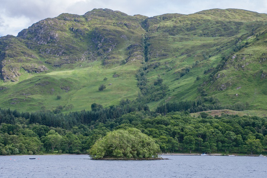
Neish Island
Neish Island on Loch Earn is thought to be a crannog.
A castle was built on the island by the Neish family and occupied between the mid-13th and mid-15th centuries.


Alternative names for Neish Island
Ester Isle of Loch Ern; Isle of Morell; Neish Island; Neish's Isle
Where is Neish Island?
Neish Island is in the parish of Comrie and the county of Perthshire.
Grid reference: NN 6905 2422
Lat / long: 56.392090, -4.122806
OS Map for Neish Island

Crieff, Comrie & Glen Artney (Strathearn & Auchterarder)
OS Explorer map OL47
Buy from Ordnance Survey
OS Explorer map OL47
Buy from Ordnance Survey
Directions to Neish Island
Enter a starting point
Get directions

Weather at Neish Island
6°C
max 6°C / min 6°C
max 6°C / min 6°C
9km/h ENE
1004mb
61%
100%
04:44 19:44
1004mb
61%
100%
04:44 19:44
Overcast clouds
Weather observed at Comrie at 16:27

References (websites)
Ancient sites near Neish Island
Castles near Neish Island
Pictish stones near Neish Island
Pictish sites near Neish Island
Accommodation near Neish Island
Drummond Hotel
0.4km away
The Four Seasons Hotel
0.4km away
Clachan Cottage Hotel
9.4km away
Comrie Croft SYHA Hostel
11.1km away
Ardeonaig Hotel and Restaurant
11.7km away
Balquhidder Braes Log Cabins
12.2km away
Mhor 84 Motel
13.2km away
The Courie Inn
14.6km away
Airlie House Bed and Breakfast
14.7km away
Braveheart Backpackers
14.8km away
Accommodation search
Cafés, restaurants & bars near Neish Island
Drummond Hotel
0.4km away
Torlum Café, Auchingarrich
10.7km away
Mhor 84 Motel
13.2km away
The Courie Inn
14.6km away
Inn At Strathyre
14.8km away
Famous Grouse Experience
16.5km away
Knock Castle Hotel & Spa
17.1km away
Poppies Hotel and Restaurant
17.2km away
Dreadnought Hotel
17.4km away
Mhor Bread
17.4km away


