Muirheadstone
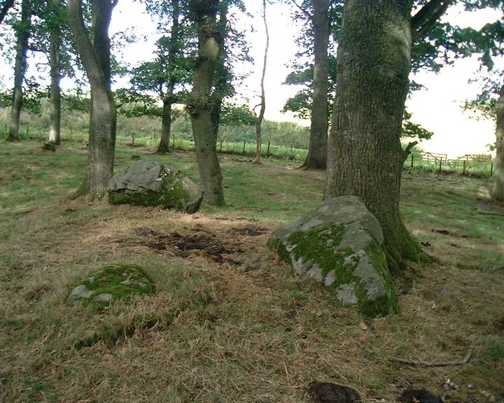
Here, close to the Staredam stones, is what appears to be the remains of a four-poster stone circle. There are three stones on the corners of a rectangle – the place where the fourth stone should be appears to have suffered soil erosion, so the stone has maybe toppled down the hill or been moved. There are a few likely candidates nearby.
There are 2 larger stones, and one smaller. The 2 large ones are aligned N-S, while the smaller one is aligned with one of the larger ones E-W. The size of the rectangle is approximately 3m N-S by 1.5m E-W.
The stones stand on a small mound on top of a big spur of land, which looks like it might have been accentuated artificially, although it’s too big to be entirely man-made.


Alternative names for Muirheadstone
Muirheadston
Where is Muirheadstone?
Muirheadstone is in the parish of Auchtergaven and the county of Perthshire.
Grid reference: NO 0499 3787
Lat / long: 56.52271418, -3.545976186
OS Map for Muirheadstone

Directions to Muirheadstone
Enter a starting point
Weather at Muirheadstone
max 12°C / min 7°C
1028mb
59%
70%
04:53 19:32
Broken clouds
Weather observed at Bankfoot at 11:21


