Mill Cairn
Alternative names for Mill Cairn
Loch Lomond; Mill of Ross
Where is Mill Cairn?
Mill Cairn is in the parish of Buchanan and the county of Stirlingshire.
Grid reference: NS 3669 9673
Lat / long: 56.13505109, -4.629721081

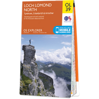
OS Map for Mill Cairn
Directions to Mill Cairn
Enter a starting point
Get directions

Weather at Mill Cairn
6°C
max 7°C / min 6°C
max 7°C / min 6°C
8km/h WNW
1010mb
94%
72%
04:49 19:43
1010mb
94%
72%
04:49 19:43
Broken clouds
Weather observed at Garelochhead at 22:43
References (websites)
Ancient sites near Mill Cairn
Castles near Mill Cairn
Pictish stones near Mill Cairn

Pictish sites near Mill Cairn
Accommodation near Mill Cairn
Rowardennan Hotel
2.6km away
Rowardennan Lodge SYHA Hostel
2.6km away
The Inn At Inverbeg
2.7km away
Lodge on Loch Lomond Glasgow
3.4km away
Loch Lomond Arms Hotel
3.9km away
Balmaha House Bunkhouse
7.8km away
The Oak Tree Inn
8.1km away
Tarbet Guest House
9.4km away
Burnbrae B&B
9.9km away
Village Inn
10.0km away
Accommodation search
Cafés, restaurants & bars near Mill Cairn
Rowardennan Hotel
2.6km away
Loch Lomond Arms Hotel
3.9km away
The Oak Tree Inn
8.1km away
Macdonald Forest Hills Hotel & Resort
10.5km away
The Winnock Hotel
13.4km away
Best Western Buchanan Arms Hotel & Spa
13.6km away
Cameron House on Loch Lomond
13.6km away
Ardencaple Hotel
15.9km away
Ardardan Tearoom
18.5km away
Killearn Hotel
18.9km away


