Kerrowmore
As late as 1848 a small stone circle was said to stand at Clachaig near the site of St. Brandan’s Church (Cladh Bhranno cemetery), although by 1888 there was nothing to be seen.

Alternative names for Kerrowmore
Clachaig
Where is Kerrowmore?
Kerrowmore is in the parish of Fortingall and the county of Perthshire.
Grid reference: NN 58 46
Lat / long: 56.589004, -4.305743
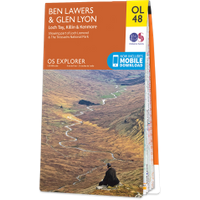
OS Map for Kerrowmore
Directions to Kerrowmore
Enter a starting point
Get directions


Weather at Kerrowmore
6°C
max 6°C / min 6°C
max 6°C / min 6°C
15km/h NNE
1004mb
52%
100%
04:44 19:45
1004mb
52%
100%
04:44 19:45
Light rain
Weather observed at Aberfeldy at 13:52

References (books)

References (websites)
Ancient sites near Kerrowmore
Castles near Kerrowmore
Pictish stones near Kerrowmore

Pictish sites near Kerrowmore
Accommodation near Kerrowmore
Ben Lawers Hotel
11.5km away
The Bridge Of Lochay Hotel
12.4km away
Killin Hotel
13.2km away
Braveheart Backpackers
13.2km away
Ardeonaig Hotel and Restaurant
13.6km away
The Courie Inn
13.7km away
Macdonald Loch Rannoch
14.1km away
Dunalastair Hotel
14.4km away
The Kenmore Hotel
18.8km away
Coshieville House
19.4km away
Accommodation search
Cafés, restaurants & bars near Kerrowmore
Glenlyon Tearoom
0.7km away
The Courie Inn
13.7km away
Macdonald Loch Rannoch
14.1km away
Dunalastair Hotel
14.4km away
House of Menzies
24.7km away
Drummond Hotel
24.7km away
Aberfeldy Weem Hotel
25.8km away
Mhor 84 Motel
26.2km away
The Watermill
27.1km away
Habitat Café
27.2km away


