Duns Law
Where is Duns Law?
Duns Law is in the parish of Duns and the county of Berwickshire.
Grid reference: NT 78500 54680
Lat / long: 55.784995, -2.344308

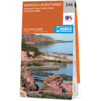
OS Map for Duns Law
Directions to Duns Law
Enter a starting point
Get directions

Weather at Duns Law
10°C
max 10°C / min 8°C
max 10°C / min 8°C
25km/h NW
1013mb
58%
78%
05:00 19:17
1013mb
58%
78%
05:00 19:17
Broken clouds
Weather observed at Duns at 17:29
References (websites)
Ancient sites near Duns Law
Castles near Duns Law
Pictish stones near Duns Law


Pictish sites near Duns Law
Accommodation near Duns Law
Pavilion Lodge, Duns Castle
0.6km away
Bank House, Duns
0.8km away
West Lodge, Wedderburn Castle
2.6km away
Garden Cottage, Wedderburn Castle
2.7km away
Groom's Cottage, Wedderburn Castle
2.7km away
Keeper's Cottage, Wedderburn Castle
2.7km away
Allanton Inn
8.1km away
The Wheatsheaf Restaurant With Rooms
8.8km away
The Craw Inn
9.0km away
SlowSheep@theLazyFox
13.7km away
Accommodation search
Cafés, restaurants & bars near Duns Law
Allanton Inn
8.1km away
Hirsel Cottage Tea Room
15.0km away
Castle Hotel
16.0km away
The Courtyard Restaurant, Floors Castle
21.2km away
The Terrace Café, Floors Castle
21.7km away
Smeaton Nursery Gardens & Tearoom
30.6km away
George & Abbotsford Hotel
31.4km away
Macdonald Marine Hotel & Spa
39.3km away
Baxters Selkirk
39.8km away
Selkirk Deli
40.8km away


