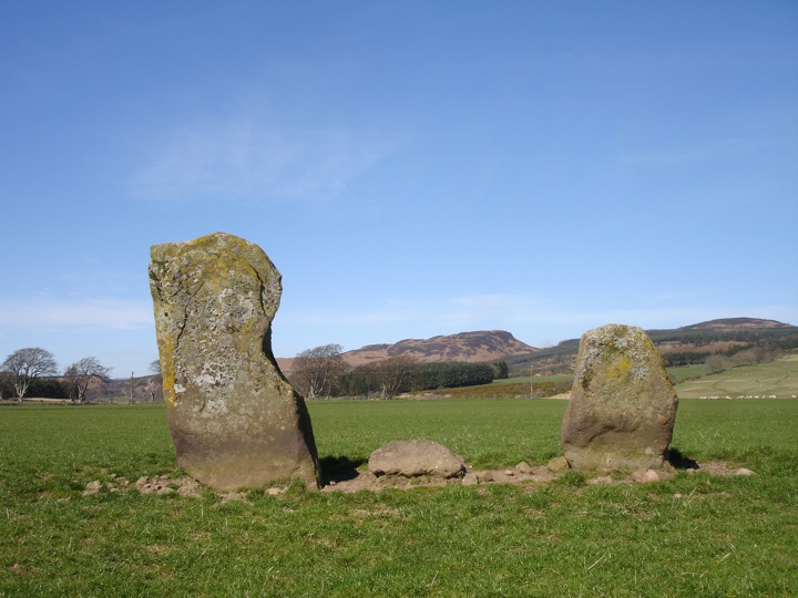
Dalchirla
This pair of standing stones stand on the wide, flat flood plain of the Machany Water, a few hundred metres from their solitary neighbour in a nearby field. Unlike most Perthshire stone pairs, these stones are of a similar shape to one another, although there is a significant difference in size. Between the stones is a small boulder described as being earthfast, although whether it is significant or just old field clearance is unclear.
The larger stone measures 2.34m in height, while the smaller stone measures 1.32m tall. The stones stand approximately 2.50m apart.


Alternative names for Dalchirla
Dalchirla (Muthill); Dalchirla Farm; Muthill
Where is Dalchirla?
Dalchirla is in the parish of Muthill and the county of Perthshire.
Grid reference: NN 8244 1588
Lat / long: 56.32006368, -3.901649871
OS Map for Dalchirla

OS Explorer map OL47
Buy from Ordnance Survey
Directions to Dalchirla
Enter a starting point

Weather at Dalchirla
max 8°C / min 7°C
1024mb
63%
34%
04:58 19:30
Scattered clouds
Weather observed at Crieff at 19:06


