Craigiedun
Two seperate authors writing in the 1920s in books about Pitlochry mention stones from a destroyed stone circle lying at the end of the golf course. However the RCAHMS found “no trace of these stones”.
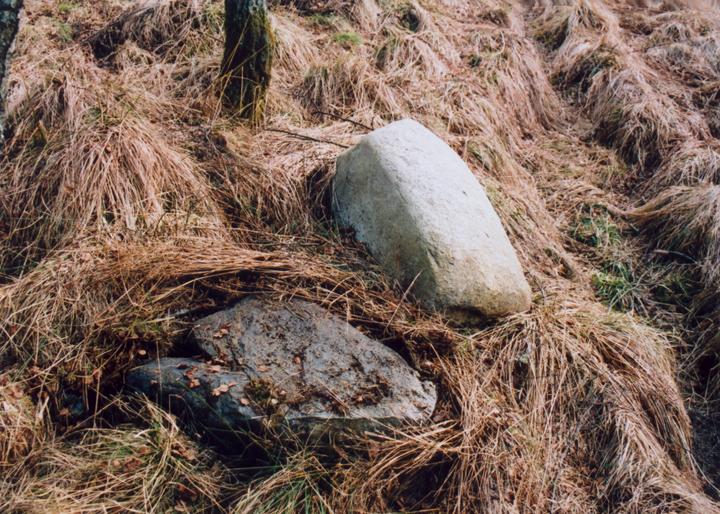
The land is marked on the OS Explorer map as marshy and is now wooded, so it’s not the easiest ground to explore however there are some stones are here, some of them turfed over, but here nonetheless just next to hole six which is called “Druid Stones”.
A bit of poking around and scraping away of long grass and mud revealed 4 large stones. I didn’t find the ten foot long stone described in 1925, as a party of golfers were getting more and more suspicious. But there were several long bumps in the ground which could do with a better look.


Alternative names for Craigiedun
The Druid Stones
Where is Craigiedun?
Craigiedun is in the parish of Moulin and the county of Perthshire.
Grid reference: NN 9288 5962
Lat / long: 56.71589081, -3.751624941
OS Map for Craigiedun

Directions to Craigiedun
Enter a starting point
Weather at Craigiedun
max 1°C / min -1°C
1027mb
76%
99%
04:53 19:33
Overcast clouds
Weather observed at Pitlochry at 02:43

References (books)

Pitlochry, 1923
Pitlochry, 1925


