Cloyhouse Burn
Where is Cloyhouse Burn?
Cloyhouse Burn is in the parish of Stobo and the county of Peeblesshire.
Grid reference: NT 1783 3975
Lat / long: 55.64389006, -3.306171639

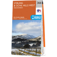
OS Map for Cloyhouse Burn
Directions to Cloyhouse Burn
Enter a starting point
Get directions

Weather at Cloyhouse Burn
6°C
max 6°C / min 5°C
max 6°C / min 5°C
5km/h W
1014mb
86%
67%
04:57 19:26
1014mb
86%
67%
04:57 19:26
Broken clouds
Weather observed at Peebles at 06:38
References (websites)
Ancient sites near Cloyhouse Burn
Castles near Cloyhouse Burn
Pictish stones near Cloyhouse Burn

Pictish sites near Cloyhouse Burn
Accommodation near Cloyhouse Burn
Stobo Castle
3.1km away
Barns Tower
3.7km away
Drochil Castle Farmhouse
4.1km away
Cringletie House
7.4km away
Cross Keys Hotel, Peebles
7.4km away
Castle Venlaw Hotel
7.5km away
Manor Water Cottage
8.3km away
Barony Castle
9.5km away
Horseshoe Inn
9.9km away
Macdonald Cardrona Hotel, Golf & Spa
11.6km away
Accommodation search
Cafés, restaurants & bars near Cloyhouse Burn
Stobo Castle
3.1km away
Dawyck Café
4.7km away
County Inn
7.3km away
Cringletie House
7.4km away
Castle Venlaw Hotel
7.5km away
Barony Castle
9.5km away
Horseshoe Inn
9.9km away
Kailzie Gardens Restaurant
10.3km away
Whitmuir The Organic Place
11.4km away
Macdonald Cardrona Hotel, Golf & Spa
11.6km away


