Clach na h'Iobairte
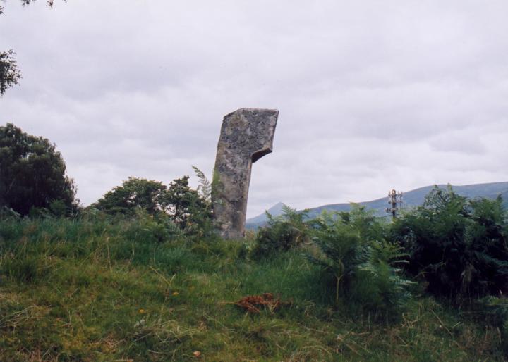
Clach na h’Iobairte stands on a small cairn which itself stands on top of a low natural knoll overlooking Loch Rannoch, with views towards Schiehallion. The stone itself is an interesting shape, reminiscent of a taller Cona Bhacain, with a protruding “head” at the top.
The stone measures approximately 0.6m wide across this “head”, but only 0.3m wide further down on the main shaft. It is approximately 0.2m thick, and would stand to a height of around 1.9m if it was completely upright, but it leans heavily to the south. The stone is aligned approximately NE-SW along it’s widest face.


Alternative names for Clach na h'Iobairte
Clach Na H-Iobairte
Where is Clach na h'Iobairte?
Clach na h'Iobairte is in the parish of Fortingall and the county of Perthshire.
Grid reference: NN 6171 5896
Lat / long: 56.70143216, -4.25901823
OS Map for Clach na h'Iobairte

Directions to Clach na h'Iobairte
Enter a starting point
Weather at Clach na h'Iobairte
max 6°C / min 6°C
1026mb
73%
16%
04:58 19:33
Few clouds
Weather observed at Aberfeldy at 19:48


