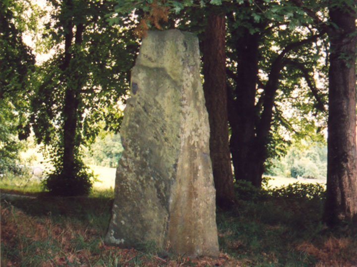
Balnakeilly
There is some debate as to whether this is a genuine standing stone, or a mid- to late-19th century adornment. It stands amongst tall trees beside the gates to Balnakeilly House, and certainly looks real.
It has been suggested that tool marks found on the stone mean it is likely to be modern, although having seen similar marks on undoubtedly ancient stones, I don’t buy this theory. It’s position makes it unlikely to have been erected in the 19th century, hidden as it is from the road by the trees, and tucked in behind the gate post.
I certainly believe this is the real deal.
Height – 2.44m tall.


Where is Balnakeilly?
Balnakeilly is in the parish of Moulin and the county of Perthshire.
Grid reference: NN 9463 5943
Lat / long: 56.71450446, -3.722146413
OS Map for Balnakeilly

Directions to Balnakeilly
Enter a starting point
Weather at Balnakeilly
max 9°C / min 7°C
1003mb
43%
100%
04:41 19:44
Overcast clouds
Weather observed at Pitlochry at 16:16


