Balhomais
This site would be easy to miss if it were not marked on the OS map as a Tumulus. It originally comprised of a barrow surrounded by a stone circle that may have been as much as 22.0m in diameter (according to the OS map of 1900).
Over the years the barrow has been quarried away in places, so that it is now only 14.0m in diameter. Five stones are visible – two standing in their original positions, and a third incorporated into the wall of the field which may be in its original position. One other stone has fallen, and the fifth only just protrudes out of the ground. At the farmhouse to the N (NN 8236 4947) is a large rock with cup-marks which is thought not to be in it’s original position. Whether or not it ever formed a part of the circle is unclear.
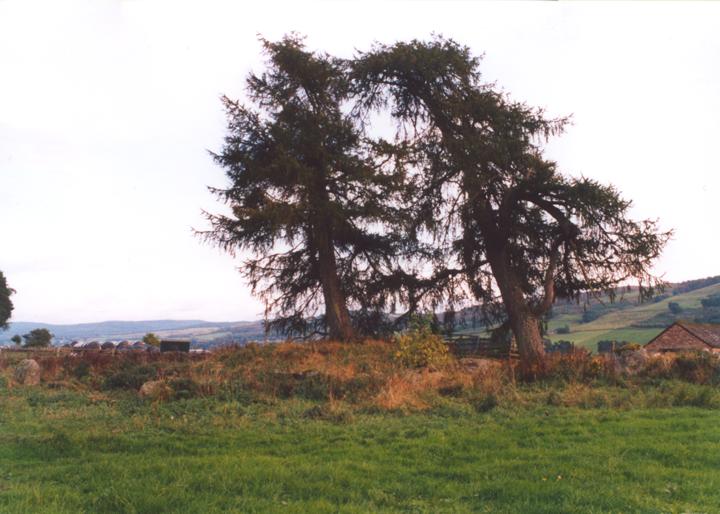
Balhomais is a confused site, overgrown, with scattered stones. From the top of the barrow grow two pine trees, said to have been used by the Menzies family from nearby Castle Menzies as gallows.
the stones are graded in height from N to S:
N stone – 1.10m tall
S stone – 1.70m tall
fallen stone – 1.80m long
buried stone – protrudes 0.50m
circle diameter – 22.00m
barrow diameter – 14.00m
barrow height – 1.50m


Alternative names for Balhomais
Weem
Where is Balhomais?
Balhomais is in the parish of Dull and the county of Perthshire.
Grid reference: NN 8238 4926
Lat / long: 56.61997308, -3.918335991
OS Map for Balhomais


Directions to Balhomais
Enter a starting point


Weather at Balhomais
max 3°C / min 3°C
1027mb
83%
25%
04:54 19:33
Scattered clouds
Weather observed at Aberfeldy at 23:41
References (books)

References (websites)
Scottish Megaraks - 13th October 2002
Stone Circles of Angus & Perthshire - Megaraks 13th October 2002
Stone Circles of Angus & Perthshire - Balhomais page


