Auchingarrich
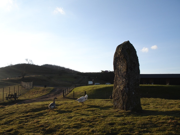
This huge standing stone measures an impressive 2.61m (8′ 7″) tall, rising from the centre of an obvious round mound which is almost certainly artificial, or at least an artificially-enhanced natural knoll. Some large stones, which may actually be bedrock, can be seen poking through the grass at the side.
It is sometimes known as the “Roman Stone,” a name applied erroneously to several standing stones in this area as a result of the Roman activity at Dalginross, and reflecting the belief recorded in the OS Name Book of 1860 that it marked “the grave of one of the heroes who fell at the battle of Mons Grampus.”
Standing next to the shop and café of the Auchingarrich wildlife centre, this site commands good views over the surrounding area, and stands at a height of 450 feet above sea level.


Alternative names for Auchingarrich
Auchingarrich Farm; Roman Stone
Where is Auchingarrich?
Auchingarrich is in the parish of Muthill and the county of Perthshire.
Grid reference: NN 7873 1958
Lat / long: 56.35235717, -3.963147452
OS Map for Auchingarrich

OS Explorer map OL47
Buy from Ordnance Survey
Directions to Auchingarrich
Enter a starting point
Weather at Auchingarrich
max 8°C / min 7°C
1012mb
79%
64%
04:58 19:31
Broken clouds
Weather observed at Comrie at 02:28


