Abbots Deuglie
Alternative names for Abbots Deuglie
Abbot's Deuglie
Where is Abbots Deuglie?
Abbots Deuglie is in the parish of Arngask and the county of Perthshire.
Grid reference: NO 109 110
Lat / long: 56.28316325, -3.439359358

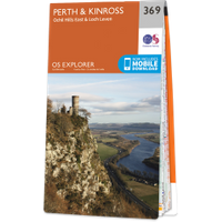
OS Map for Abbots Deuglie
Directions to Abbots Deuglie
Enter a starting point
Get directions

Weather at Abbots Deuglie
5°C
max 7°C / min 4°C
max 7°C / min 4°C
4km/h NNE
1025mb
66%
26%
04:56 19:28
1025mb
66%
26%
04:56 19:28
Scattered clouds
Weather observed at Milnathort at 20:17

Ancient sites near Abbots Deuglie
Castles near Abbots Deuglie
Pictish stones near Abbots Deuglie
Pictish sites near Abbots Deuglie
Accommodation near Abbots Deuglie
Glenfarg Hotel
2.8km away
The Famous Bein Inn
5.4km away
Thistle Hotel, Milnathort
6.4km away
Bronton Cottage B&B
7.2km away
The Muirs Inn
8.1km away
Windlestrae Hotel and Leisure Club
8.2km away
The Green Hotel Golf & Leisure Resort
8.4km away
The Kirklands Hotel
8.5km away
Acer Guesthouse
11.6km away
Tullibole Castle Longhouse
11.9km away
Accommodation search
Cafés, restaurants & bars near Abbots Deuglie
The Famous Bein Inn
5.4km away
Windlestrae Hotel and Leisure Club
8.2km away
The Green Hotel Golf & Leisure Resort
8.4km away
Best Western Queens Hotel & Leisure Club
12.1km away
Breizh
12.6km away
An Lochan Tormaukin
13.4km away
Luigino's
14.7km away
The Covenanter Hotel
14.7km away
Holiday Inn Express Perth
15.0km away
Huntingtower Hotel
15.1km away


